Tuesday, 15 January 2013

The Number 498 Route

Romford Station to Brentwood (Sainsbury’s)
Thursday June 7th 2012

After a fairly slow start to the day due to a very infrequent service, a mere 15 minute wait at the lively bus stops by Romford Station posed few problems. It had not yet started raining and it was half-term so there was plenty of ‘people watching’ to be had. The buses come as thick and fast as the waiting passengers and when our 498 rolled up the throng (cannot be called a queue) surged and Jo and I found ourselves not only separated but she without a seat for the entire journey, so full was this route, running three times an hour. I guess it had been Market Day in Romford and most passengers stayed on till Brentwood. It was a smallish bus with a buggy getting stuck and having to de-board and re-board via the middle doors. Though mid-June the bus seemed full of germs with sundry heavy coughing going on – Jo later said that she overheard the perpetrator saying she had what can only be described as poorly managed asthma.

From this you will gather life on board offered rather more novelty than passing the familiar landmarks of the Romford one-way system and leaving by the roundabout with the hotel and Town Hall gracing it. By the time you read this the events will be long past but we were travelling in the week of the Jubilee Celebrations and flags and bunting were still very much in evidence. (As well as the indifferent weather)

But that is about all that was to be seen – this is a completely straight route out of Romford with post war housing where the front gardens have frequently been suppressed.  It’s also a while since we mentioned that favourite building material – pebbledash – of which there were some fine examples.  A novel use for a former petrol station was the Wax-on Centre with no fewer than three people polishing one car – hand-finished indeed!  The main landmark along here is the Gallows Corner retail park with Tescos tucked behind but noone was doing much retailing or parking (or indeed hanging) today. (The 499 account will tell you how we got out of Tescos, which is not well served by buses)

Thereafter we pretty much sped along with houses further and further back from the road by now became the A12 and dual carriageway, so by the time of Gubbins Lane (what a lovely thought) there were just some hedges and walls visible. The bus pulled in at various lay-bys to take on more passengers with occasional signs to the Marylands Golf Club or Old McDonald's Farm Park  – perhaps more Peppa Pig than Gloucester Old Spot. (or even, thanks Mrs Redboots, Giggly Pig)

The road signs were keen to offer us the Dartford Crossing but obviously this is a local bus. The ‘voice-over’ told of a stop called ‘The Bull’ but all I could see was a ‘Nag’s Head’ so not sure what was going on there – they looked the sort of pubs that might be good for a Sunday lunch or evening pint.

I was a bit confused that there was more than one reference to ‘South Weald’ (as in SW Luxury Care Home’ as I had always thought the Weald was down in Kent and Sussex, but further investigation indicates it is part of Brentwood Local Authority. 


Brentwood itself has a long and in parts historic high street including a memorial to a local martyr, William Hunter who aged 19 declined to adhere, even after threats and substantial bribes,  to the re-instated by Mary Tudor Catholic dogmas and was burnt for his beliefs. Brentwood School was founded on the site.  We rode  the High Street one way and partially walked back. Most passengers got off for the shops and this is the point to say that on both our Essex buses today every single passenger was of the same ethnicity, even this bus which carried the full age range of passengers, not just the Freedom card holders. In amongst some old-fashioned shops  there was also some street sculpture for which there was no visible explanation so clearly the locals must know what the pierced column carvings actually represent.

The bus terminates round the corner close to Sainsbury’s and thanks to some fast action along the road out from Romford took just over ½ hour. 

Monday, 14 January 2013

The Number 497 Route (not)

Monday 14 January 2013

This is the last time we shall post a non-bus, so we thought it was time to tell you our plans from now on.  The 498 and 499 - coming soon - are the last routes in the main number sequence.  A few of London buses are numbered in the 500s, and we shall, of course, travel and post the stories of these routes.

The 497 does exist, by the way:  it would take you to Great Yarmouth for sea and sand, funfair and ice cream, if not actually sunshine at the moment.  But it is a National Express coach, and therefore none of our business.

Now, where was I?  Oh yes, the future:    we shall not be travelling the Night Bus routes; they are too late for us and also the chances of getting vomited upon are too high.   And as you all know, almost all 600s are school journeys only. Here is a list of them.  There are a couple of 'ordinary' 600s which we shall come to in due course.  We shall be travelling the few 500s and 600s which remain and then moving on to the letter buses.

The Rules Committee is still pondering how best to travel these London buses (there are over 100 of them).  We are still uncertain, for example, whether we shall do all the 'B's before moving on, or whether we might want a change from Bexleyheath from time to time.  We shall let you know when a conclusion has been reached and ratified.

Meanwhile, our technical support in Milton Keynes will be making us an index of the non-route posts, when he has a moment.

The Number 496 Route


Tuesday 5 July 2011

I did this one alone, for the first time since the Number 2 Route (though the main route of the day was the 193)  And on my birthday too.  Still, it was a lovely day and I was at Harold Wood Station by 10.15, via Liverpool Street and no-train-before-09.30.  There was a 496 having a rest. but by the time I had strolled the few metres to the stop, it rolled up, and so we were off towards Queen’s Hospital, Romford, by 10.20.

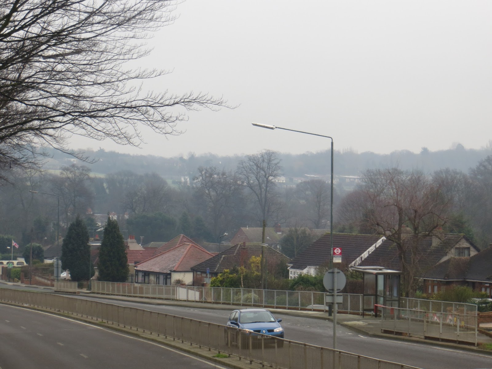
We headed through residential areas, with the traffic calmed by squeezes, so much more efficient than bumps, I always think.  We were the only bus, and though we picked up a number of shoppers, no- one else came upstairs to join me.  We went over Paine’s Brook, not that you can see much of it in the picture which seems to link the Rom to the Ingrebourne.

The housing was mainly bungalows, both before and after we crossed the A 12 and briefly joined the 174 route. We passed Drapers Academy:  I assume that their new building will be finished by the time you read this, though there was a good slide show of demolition here  when I did the journey (and there still is!)

Down Leamington Road (and quite steeply down!) we passed some public housing flats before we came to the Saxon King Pub with lots of locals disagreeing with the review here.  A short way along the road we came to the William the Conqueror, an enjoyable juxtaposition of names for a former History teacher.  I also liked the GigglyPig, a sausage shop and more.

I thought of Linda as we passed Broadford Primary School, since all their signage was in Comic Sans, which she abhors.  The bus was now much busier, as we went through the business park, across the A12 and towards Gidea Park.
Tuesday is dustbin day round here, and we were held up by the van for a while 


We passed Gidea Park Station, and then went round the roundabout at the Drill pub:  Havering is bracing itself for climate change by making some of its gardens and roundabouts drought resistant.  Interesting shop names on this journey had fishy resonances:  first ‘Codfellas’, the fish and chip shop and then ‘Wetpets’.

We have been to Romford Station very often, so I was able to concentrate more on a loud and cross conversation behind me about babysitting obligations.  But as we rounded Romford I noticed that major building works are still going on, including something that was blocking the main street. We came past the IceRink  and the Taylor Wimpey building site for Reflections (presumably fully finished and occupied by the time you read this: yes!  bus still with Taylor Wimpey fences and signs, so it may be getting even bigger)


We got to the hospital at 11.00: slightly longer than the 29 minutes suggested as we set off, but none the less, quite nippy.

Sunday, 13 January 2013

The Number 494 & 495 Routes (Not)


Again with thanks to E-Plates we have learnt that these were outer London routes – the 494 running between Oxted and East Grinstead and the 495 closer to where we were last week on the 492, namely from Northfleet to the Christianfields Estate, which would appear to be a mixed estate of council owned and privately owned Wates-style houses in Gravesend. 

---------------------------------------------------------------------------------------------------
For those of you who want them, here are the answers to the quiz set in the posting for
The Number 475 Route (not):

1.  Route 66;
2.  The Master Builder;
3.  Wagon Master;
4.  Roots;
5.  Master and Commander;
6.  US Masters;
7.  Root beer;
8.  Masterblaster;
9.  Masters of War;
10.  Levi Roots;
11.  The Master-Singers of Nuremberg;
12.  Bat Masterson;
13.  Amanda Root;
14.  View-Master;
15.  The Master and Margarita;
16.  The root of all evil;
17.  Nature's great masterpiece;
18.  The Demon Headmaster;
19.  Root canal work;
20.  Masterchef.

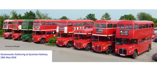
And here, for the fans of the bus that inspired the quiz, is a link to the website of the Routemaster Association, from which we have borrowed the picture 


Saturday, 12 January 2013

The Number 493 Route


North Sheen (Manor Circus)  to Tooting Broadway
Wednesday June 12th 2012

Our last bus had left us further back along the Lower Mortlake road so we walked the short way between two roundabouts – a busy stretch with workers’ cottages on one side and bland office blocks on the other – however, both pavements were wide enough to accommodate cycle tracks so bikers did not have to contend with the very heavy traffic. Again it was a single decker and as we waited we noted the overflowing bin lid of dog ends – a very depressing sight. 

It’s only a short ride back into Richmond past Young’s pub and Orange Tree theatre but pausing long enough to admire Richmond’s central reservation’s hanging baskets.  The bus did not bother with the rather inadequate Richmond Bus station but headed off towards Sheen passing the splendid Christian Science Reading Room – bigger than some local libraries. This particular faith brand used to have higher profile but they seem to have been overtaken in the quirky faith stakes.

The bus passes two sets of Almshouses in quick succession, starting with the Houblon Almshouses built by the Huguenot sisters Rebecca and Susanna whose father was Lord Mayor and something big at the Bank of England; their largesse extended to brown gowns once a year for the female residents. Next come Hickey’s Almshouses – the origins of Mr Hickey’s wealth are not specified but his trustees built homes for both men and women. The exteriors are largely unchanged.

Sheen is clearly ripe for interesting building as not much further along we were astounded to see the extent of the  Courtlands development. The site has a long history but the substantial blocks date very evidently from the Thirties – we guessed there might be a shortage of parking (though the station is close) but the original architects had factored in garages also. To all intents and purposes this is actually the South Circular road and the bus follows it, passing Rosslyn Park Rugby Ground, the Sheen Garden Centre and the strangely named  ‘Lofty Turtle’ bar, until it takes a circuitous right turn along Roehampton Lane. The turning is still called the Red Rover in memory of the pub that stood here. In the Sixties I worked with a special school in Putney and the Head would often pop down here for a quick lunch-time ½ pint – how times have changed.  Roehampton Lane is now quite impressive as the University of Roehampton has unified the various colleges along here which all offered well-established teacher training courses. Maybe it was exam time or term has finished but it seemed pretty quiet.      

The end of the lane delivers traffic into Roehampton, a former village with extensive public housing grafted on since the Sixties. I cannot pretend the two have ever quite gelled but certainly the Roehampton Estate gets a wider range of bus services than it used to. However that was not our destination today, so we paid our respects to the Roehampton Drinking Fountains (people and horses) guarded by some distinctive putti. (P) Talking of guardians, we saw several policemen today – 2 on horseback enjoying the sun and the heath and two seemingly standing guard over the Waitrose on Upper Richmond Road…

The Queen’s Own Surrey Regiment has a rather hidden war memorial, though that may be due to exuberant tree growth, as we sped along the side of Putney Heath past the Tibbets Corner roundabout and as if along to Wimbledon Park Side as the grown up Route 93 does.  However, if you have been paying attention you know the higher route numbers take the less obvious roads and so it was that we found ourselves heading to Wimbledon via Augustus Road and Southfields. There is quite dense housing here (though fortunately nothing too high-rise) and therefore an appropriate complement of schools.  Jo was taken with Our Lady of Lourdes have recently returned from the original site of the visions; next door was St.John Bosco College also RC but of whom we had no knowledge. He seems to have believed that teaching methods based on love achieve more than those based on punishment so that sounds like a good enough role model.

By the time we arrived in Southfields, which links this bit of London in via the District Line, we had swapped the 93 route for the 39. Southfields is of course the station you should choose if you want to visit the tennis, rather than the much more remote and over the hill Wimbledon. When the tournament is on they tend to run shuttles from Southfields to the All England Lawn Tennis Club which sits behind a long wall (I expect that’s why they only have single deckers) punctuated with thematic metal grilles. It will probably be mid-winter by the time you read this but as we came along the 2012 tournament was only 10 days away and they were still working frantically on the road surfaces, which led to a certain amount of hold up. The tennis bits of the Olympics will also be taking place here of course. Other hold ups included two cash paying /no change passengers. Opposite the AELTC is the very lovely Wimbledon Park, through which the Capital Ring walk takes you – a park complete with lake, and Capability Brown had a hand in designing it . .

The lake I believe is a bit of diverted River Wandle and we were to meet it further down the line. Church Road brought us out in the middle of the very charming (and expensive – this where the players shop ‘locally’) Wimbledon village, before plunging down Wimbledon Hill – this is not a route that lingers in the modern town centre but we noted that Ely’s Department Store did not seem to belong to the usual John Lewis/Debenhams groups and subsequently found it is actually one of the group of 8 remaining independent department stores dotted around London, including Pearsons in Enfield and others.

This route follows others along the substantial railway lines where Waitrose have recently opened a branch, which must boost passenger numbers somewhat. More enigmatic is the unnamed cemetery  along Gap Road  To quote Darren Beach: ‘ A measure of how little consideration is usually given to this cemetery is that even Merton Council seems reluctant to give much information…’  We have been past several times and it does not even seem to have a visible name board.

The surroundings change radically at this point.  Though the Wandle (which we crossed near Plough Road) is no longer the industrial river it once was the area is full of business parks, workshops, large warehouses,outlets etc which doubtless serve both Wimbledon and Tooting just over the horizon. We stopped in one such location for the drivers to change – this seemed a deeply puzzling place to swap over with the mini-hub of St George’s just round the corner.
 
The 493 finishes by paralleling the walls of Lambeth’s Cemetery and Crematorium in Blackshaw Road.  It boasts few ‘names’ except for Charlie Chaplin’s father in an unmarked grave, which tells you something about that family’s early poverty. At the end of Blackshaw Road is St George’s Hospital now well settled in this part of London after its post war re-location. St George’s is well supplied with buses and is also close to the Northern Line on Tooting Broadway. We stayed on because that is what we do (end to end of every route) but it would have been much quicker to walk than wait ages to come out of the side road and edge along the quite narrow High Street. As we got out we realised the 493 does another loop to finish back at the hospital – something of a glutton for punishment as we had already been underway for 90 minutes!

Lunch and other chores took precedence on reaching the last stop so there.       

If you're exhausted reading this think how we were after this epic south-west London trip.

Friday, 11 January 2013

The Number 492 Route

Thursday 10 January 2013

Linda and I were delighted to have Mary back with us after all the Christmas festivities, and we met at Sidcup Station, to take the 492 to Bluewater.  As an uneven number of London Buses serves the great shopping experience in the chalk quarry, we had known for many months that we should have to come back one more time.  Two charming railway people at Sidcup Station, who told us where the bus stop was, offered us faster ways to get to Bluewater, but we gave them a card to explain why we were taking the almost-an-hour bus.

We climbed aboard at 10.40, and were the only people on the double decker for some time. Heading out past Marlowe House, which held bleak memories for my travelling companions from their working years, we turned left along Sidcup Parade, passing an Iceland which had clearly once been something grander, as well as the Tailor's Chalk Pub.  The name comes from the fact that the premises once housed a bespoke tailor, as well as a dry cleaner.  Let me say, not for the first time, how much we appreciate Wetherspoons' willingness to explain their pubs' names.  We wondered whether the new Travel Lodge is on the site that might have been a Waitrose, and sure enough, the Bexley Times seems to suggest that John Lewis has been behaving less than well


Coming past Rectory Lane, we noted some new homes for sale, including some with three bedrooms, and some for shared ownership.  They are available for £300,000...  Then, as we headed down the hill, we passed an enormous Chartered Accountants' office, with a clock.  Then we admired a house which seemed to date from an earlier age, as well as catching a glimpse of the River Cray.  By now we were into Footscray, and Footscray Meadows were looking green and pleasant:  but the steamed up bus windows of this cold and slightly foggy day made photography unrewarding.

This is a mainly residential area:  there were bungalows to our right, and substantial semis along a service road to our left.  Then for a while, we felt as if we were almost into the country (horses in a field!) before coming to Bexley Village, the village sign sponsored by a supplier of Bifold Doors.  Through the village, the road felt more like a lane, narrow and winding.  The inn sign of the Coach and Horses pub had faded to white, but the pub itself appeared to be flourishing:  in fact we remarked that we saw a number of healthy pubs and no closed ones on this trip.  

A large house on the High Street has a blue plaque for John Thorpe but it's not an English Heritage plaque.  Here is a closeup.  I think he was the person who persuaded everyone who mattered in the 18th century that Stonehenge was interesting, and thus helped ensure the stones were not used for other purposes.


Bexley Village Library is a charming little building:  there is a notice outside that says how many books it had -7670-   and we hoped it would survive.  The village also has a pub called The George.  Judging by the Inn sign, we thought it was probably George II but, you've guessed, I can't find a website that specifies.  We spotted some signs for an over 30s night club but, regrettably, did not have time to note details or even a website.  And of course, we don't know if it means WELL-over 30s, so it was probably not for us.

A bridge over the A2 brought us rapidly into Bexleyheath, where we admired what had clearly once been a fine cinema and was now Gala bingo.  We have been here often before, and so were not taken aback by the little twiddle that takes buses into the small town centre station.  A group of police officers at the bus stop, studying a leaflet and talking on their phones made us assume they were looking for a missing person, though whether criminal or not we could not guess.  Of course Bexleyheath has an ENORMOUS police station, unlikely to be closed whatever happens to others.

Heading along Mayplace West and then Mayplace East, we were back into residential housing, some modern terraces with 'Georgian' bow windows, but also sizeable semis with hardened front gardens.  Allotments and a sports club brought a bit of green, as did the pretty graveyard of St Paulinus' Church.  St Paulinus is the one who came in the second wave, after St Augustine (we are talking the 7th century here) and went north when a Kentish Princess was sent to marry King Edwin of Northumbria, then a pagan.  So he is really the apostle of the north, but commemorated here in Kent, where his career began.

Crayford has a number of pubs.  The Duke's Head looked as if it might be Wellington, since he was in a military scarlet coat.  The Bear and Ragged Staff is of course the emblem of Warwickshire, and we have, on recent trips, passed pubs named for the earl of Warwick, so maybe the Earls had interests in brewing.

As we crossed the River Cray, we saw a notice which piqued our interest.  The Wigglers appear to be linked to greyhound racing in Crayford.  We, of course, know more about the Walthamstow track, which  has been very much in the news.

Station Road took us uphill past Crayford Station and  back into a residential area, where the only parade of shops we passed consisted of fast food outlets and hair dressers.  And yet we were the only bus along here.  As we turned into Shepherds lane, I was quite excited to see a segregated cycle track on the right hand side of this busy road but, alas, it did not last, petering out just by the first of Dartford's two Grammar Schools.  It is of course the Boys' version that has the more famous alumnus.


 We continued fairly steeply down West Hill, where we guessed that the large and distinguished building to our left must have been a workhouse or some such.  And indeed it had been.  The centre of Dartford seems to us dominated by the footbridge that takes people across to the station, but that view may have been coloured by the fact that we knew we should soon be needing to head home from Bluewater, from that very station.  At the moment, after a pause beneath the bridge, we ploughed on, past the BIZNIZ centre and over the Darent.

We were interested in the offset position of the clock on the tower of Holy Trinity Church, deducing that the medieval tower and window predated the clock by some centuries.

But we were nearly at our destination:  we passed several more pubs (the Welsh Tavern had the Prince of Wales' feathers for its sign;  another Woodman, to go with the Woolwich Woodman from last week; the Welcome All pub near the much larger Bull) We aso liked the rural setting of the War Memorial at Stone.

Then we were alongside the A2, and then onto it, following the right hand bus lane that turns into Bluewater.  There seemed to be excavations going on in a field alongside, but I can't discover what they were digging for (or burying?)

We got to the not-very-beautiful bus station of Bluewater at 11.50, only a very few minutes later than the advertised time.  if only the weather had been less misty, we should have enjoyed striking views as we travelled up and down the hills of this part of north Kent.

Wednesday, 9 January 2013

The Number 491 Route


Wednesday 11 April 2012


Having taken a circular tour round the Elsinge estate (Waltham Cross) in a single decker, I was rather hoping for an upstairs for this, my third bus of the day, but I was disappointed.  I was on my own, and the whole note-taking and camera handling business is easier if one can be out of the way upstairs, but never mind.

We set off at 12.15 on what was listed as a 45 minute journey, though it was clear that this part of London was particularly slow today.  We set off along Eleanor Cross Road  to reach Monarchs Way, which seems to take traffic away from the shopping centre.

There were advertisements for the Whitewater Centre  although it is closed at the moment as far as the general public is concerned as the Olympics are coming.  As we headed along the Hertford Road, the traffic was solid in the other direction, but we were able to nip along quite smoothly.  We turned right along Solar Way and then along Innova Way to serve the Innova Business Park, though no-one, as it happens, wanted to get on or off .  I thought the building labelled BIC might be the world biro HQ, but of course it stands for the London business innovation centre. 

Once out of the business park, we headed for the River Lee (spelt this way here!) and over the causeway bridge to Enfield Island.  The Street names are confirmation that the land used to belong to the small arms part of the Royal Ordnance:  a number of Georgette Heyer heroes, for instance, had Manton duelling pistols.  We had been here before on earlier buses, but it remains an attractive place, with its own narrow boat moored in one of its water features.  A number of people got on to leave the island, as we passed the splendid hawthorn blossom of Velocity Way and Ordnance Road, crossing the small River Lea.
 
As we came to Brimsdown Station, I noted that traffic waiting to turn left was being held up by the level crossing, and then we turned through the business area to pass close to Ponders End Station and reach the High Street, where many passengers got off.  The traffic here was very slow, again, so I had time to notice the mostly hardened front gardens of the terrace houses.  I noted, for our collection, a hairdressers called Heir Kutz, as well as the Goat Pub  which seems to be a music venue.  The other pub we passed was the Wetherspoons Picture Palace.  Unusually, the Wetherspoons website does not explain the name.

The turn into Galliard Road brought us into a well-used Hail and Ride section, with substantial numbers of people getting off and on this busy bus.  Some of the front gardens here were impressively gated and fenced, and one even sported two araucaria trees, where many gardeners might think one was too many.

At this point a 491 going in the other direction met us, and I noted it was going to terminated at Brimsdown;  evidence, I suppose, of the slow traffic I had experienced or witnessed all morning.

Now we rejoined the Hertford road, to pass the King William IV pub and head to Edmonton Green Bus Station, though we did not turn into it.  Many people got off, to be replaced by many others heading home or possibly to Asda, and we were slowed by some roadworks of an indeterminate nature.

We passed both the Salvatioin Army and the Mevlana Rumi Mosque.  This is the branch of Islam famed for its ‘whirling Dervishes’ but the mosque was merely a quiet house. 

We also came to the Edmonton Labour HQ, with its signage for the MP Andy Love,   a surname we very much like. (hello to the Leicestershire Loves...)

After that we came, comparatively swiftly, to Silver Street Station, and popped onto the  North Circular for a few metres to reach the North Middlesex Hospital.  It was 13.25, not exactly the journey length suggested, but we had often said that we think the bus stop times suppose a non-existent time of day with no traffic. 

This route had linked up various places the project had visited before, and the rain had held off for the whole route.