Friday 24 February 2012

The Number 299 Route


Monday 13 September 2010

Linda and I had planned to meet at Cockfosters at 10.30, in order to take a couple of buses to the 102 and then one more.  Mary was only just back from the West Country and so it was just the two of us.  But the Piccadilly Line ensured that we were not able to start when we wanted to:  faulty signals slowed everything, and then engineers on the line between Arsenal and Finsbury Park brought trains to a standstill (they were meant to be there, you understand, not like leaves or snow).  So it was 11.55 when we finally climbed onto the single decker 299, heading for Muswell Hill.

Our direction was south, past smart shops (The Blue Olive for Greek food, for instance)
and well spaced houses.  We also –of course – noted the segregated and broad cycle track.  We entered a ‘hail and ride’ section, indicating, we thought, the 
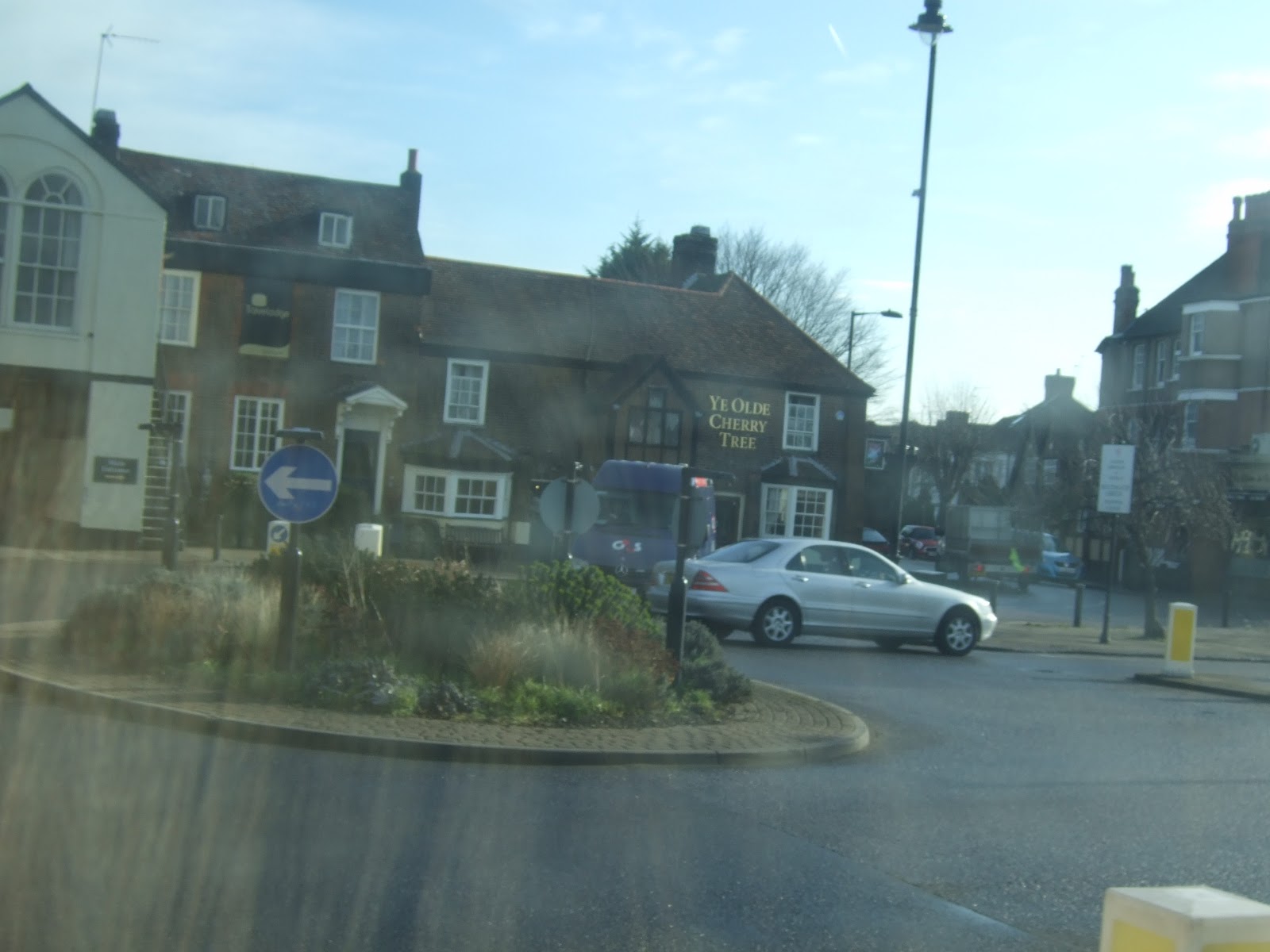
limited customer base for buses in this area.  We admired Enfield’s coat of arms on a handsome block of flats, as we headed down into Southgate, passing some distinctive homes.  There is a gigantic Asda (though of course a Waitrose as well…) and Southgate Station has a substantial bus area as well.  The Alan Pullinger Centre seems to be a thriving youth centre, but I cannot find out who it is named for, or when.  Leigh Hunt Avenue is, however, easier to explain, as the man was born here.  I put a different link on the 298 post, so if you want examples of his poems, try there.

Southgate College was busy with students coming in and out, a feature of  our whole day, perhaps because of the late start: we were to share buses with a number of school and college students, whether at lunch time or at the end of the day.  The Southgate Masonic Centre, on the other hand, was quiet at this time of day.  It is the Provincial Grand Lodge for Hertfordshire.  By the way, I do recommend the Museum at the Freemasons' Hall in Great Queen Street, which is full, as Howard Carter remarked on another occasion, of wonderful things, but only open on weekdays.


We swept on to pass Bounds Green Station, and some views of Alexandra Palace, and reached Muswell Hill by 12.20, after a short and enjoyable journey through some of the more desirable parts of outer North East London.  You only realise that it really is a hill when you look down at the views.
We are coming up to our third anniversary, so it's fitting that we shall be travelling the number 300 next week.  We continue to have fun.

The Number 298 Route

Thursday 23 February 2012

A beautiful, sunny, mild spring day awaited Linda, Mary and me as we stepped out of Arnos Grove Station and onto the 9.50 single decker that would take us to Potter's Bar.  Some buses are less frequent than others, but when they run to the times specified, planning is really easy.

We turned right and travelled through attractive blocks of flats, designed for commuters, given the utility of the Piccadilly Line.  These were interspersed with substantial houses, many with hardened front gardens and multiple cars.  The road headed under the Piccadilly Line and on towards the large Barnet cemetery.

As we came into Southgate, we noticed hat there was a Walker Cricket Club and a Walker Primary School: these are named after a long established local family, with cricketing links.  A couple of the houses had the local authority plaques on them, registering what building had once stood there, or what existing buildings had been used for.  Clearly Southgate Green is a community proud of its heritage.

We passed the Southgate Masonic Centre, as well as Leigh Hunt Drive, named for the local poet, and then reached beautiful Southgate Station.  Its curved shape and attractive detailing are a delight.  The next time underground stations were built with this kind of pride was, I suppose, the Jubilee line.
Among the many green spaces on this trip, we noted the Saracens training ground, with its peculiar little clock tower, and then we were interested to pass the headquarters of Chickenshed.  (Its own website does not give you much background detail, hence the Wikipedia link)
 We could tell we were in the smarter part of Barnet when we passed a fish shop called 'Poisson' and we were also entertained by an Italian restaurant whose offers were all in Italian - antipasti, pizze, pesce -until it came to 'Brunch'.  We have a feeling that Italians don't do breakfast, let alone Brunch, and so may not have a word for it


Suddenly we were out into what appeared to be real countryside, with horses and even a few other animals and, most surprising of all for Londoners, a genuine delimit sign:  we don't see many of them!  We had entered Hertfordshire, 'County of Opportunity', it says on the signs, and soon crossed the M25 to head along the A111.  We were going fairly rapidly, passengers clearly wanting to get into Potter's Bar itself. ( I had better mention here that some signs HAD the apostrophe and some did not, so I have gone with it)

We were interested to note that Skechers (american shoe makers and sellers, I am wearing some as I write this) have their HQ or at least a corporate building here, though our fellow passengers wanted the enormous superstore rather than shoes.  We also spotted a tattoo shop which offered laser removal as well as the actual art works.

A detour took us into the station and out again:  in the evenings this is where the route terminates, but during the day it goes on into the Cranbourne Industrial Estate, and so, of course, did we.  The route was listed as taking 35 minutes and in fact took only a little longer, dropping us, and the other two passengers, at around 10.30.

I suppose any trip would have been great on this sunny day, but this had been really attractive, taking us from the north part of London into what you might almost call rural Hertfordshire.


Friday 17 February 2012

The Number 297 Route

Willesden Bus Garage  to Ealing Broadway Station
Thursday 16th  February 2012


 Fuller length postings resume today, as Jo and Linda met at Dollis Hill Station while Mary helped out with grandchildren over half-term; we’d hoped some of the children might have joined us but not this time. Dollis Hill is the nearest Underground Station to Churchill’s very secret bomb shelter; so secret and so distant he barely used it and fortunately total defeat was averted, though Brook Drive, the actual location of the bunker, is in the opposite direction from Willesden Bus Garage where our trip started.

Talking of  Derelict London, almost immediately we spotted a rather splendid Ghost Sign saying, we think, ‘Everybody Reads the Daily Express and Sunday Express’ Well, not everyone.

The 297, always busy but not too crowded, takes a northerly direction along Neasden Lane, the only route to do so, thereby passing a range of industrial units and municipal buildings – the Magistrates Court and the Jobcentre, rather a large one on the day when the announcement came that Unemployment is the highest for 16 years. After Neasden Underground Station and copious signs to the Welsh Harp we also passed Brent Ambulance Station. It makes perfect sense to have these semi industrial business units hereabouts in an area squeezed between densely packed railway sidings and getting under the North Circular, which at this juncture is in 3-lane mode.

Once safely under we came down Blackbird Hill and Forty Lane, here doubling up with the Route 83 and others, and passing Brent Town Hall: a very Thirties build and  'The best of the pre-war modern Town Halls around London' (says Pevsner). ‘Serene composition of overlapping brick planes with design links to Dutch modernism of the 1920s. Classic 1930s council chamber’ (says the Brent Council website). So now you know.


Oh yes, and a huge Asda. Also, on quite an ordinary house, a Blue Plaque for Arthur Lucan, a Thirties era actor who played ‘Old Mother Riley’ in drag but perhaps not as famous as  the Lord Lucan of disappearing fame. By now we were getting an excellent view of the Wembley Arch seen so much better from afar.

 Empire Way also recalls the previous Wembley Stadium, built for the British Empire Exhibition 1923-4, but today, though we had a good view of the soaring arch it was not quite fully frontal as we were taking a more oblique route up the quite hilly Park Lane which passes the Edward VII Park on the right with terrific views across to Harrow on the Hill.  The raised pavements are a testament to how steep the incline is.

At the top of the hill we nipped nimbly, but never anything other than very smoothly with this driver, along a short stretch of Wembley High Road to turn into Ealing Road direction Alperton. The South Indian restaurants clustered at the start of this turning gradually give way to food shops and a range of excellent clothing shops offering wedding finery, and everything for the modern woman.  Spiritual needs are catered for by the Central Mosque Wembley and the sandstone Temple – usually it glows but does need some sunlight to help it along. There was some scaffolding round the gate so we were not sure if this meant repairs or additions.  

After crossing the Grand Union Canal, along with all other bus routes, we turned into the Alperton Sainsbury’s with its equivalent Chinese supermarket opposite, but exceptionally this route carries straight on, taking a left for Perivale and again taking on passengers as being the only route to come this way. Perivale seemed to be a mixture of more industrial units and some housing along a road that ends in Horsenden Hill, which clearly promises a lot though only glimpsed from the bus. 


Then we did a rather daring little dash alongside and eventually across the fierce A40 to take Argyle Road where the driver waited for some people running for another bus in front of ours. Jo had lost her confidence about naming rivers but I will be brave and say we crossed the River Brent at this point and after following its valley for a while climbed round Pitsanger Park and up Castlebar Hill – more green open spaces.   As is usually the case, the folks with the money live up the hill and this became clear as we passed large detached houses, modern block fill-ins and not a few private schools along street names such as The Knoll and The Mead.

Signs to Ealing Abbey and St Benedict’s School reminded us of less salubrious links to long concealed child abuse, which goes to show that private education and privacy can be mis-used by those in charge.   

St David's  home nearby is also a historic home and caters for a different age group and generation. 


We had set off thinking this was to be a repetition of several of our previous outings in NW London (Neasden/Park Royal/North Middlesex axis) but in fact the 297 offered a back view of Neasden and surprising amounts of greenery for a route that also crosses two of North West London’s key arterial roads. A pleasant contrast to the more challenging 266.  From a westerly start we had come still further west with a northerly dog leg, taking in all about an hour.


By the time we had reached the bottom of the hill, which had shown us a more affluent side to Ealing, Haven Green was in sight and the end of our trip for today.

Sunday 12 February 2012

The Number 296 Route

Romford Station to Ilford
Monday March 23rd 2009

Rather a dull spring day with a chill wind getting up, noticeable as we ‘crossed’ what was left of Romford Market (where the Number 5 see MUCH earlier) had left us, back to Romford Station to board this single decker. It whirled out of Romford, from which we felt the heart had been removed, and soon found itself on the A12 belting along in a most unbus like fashion. Clearly the passengers were all very local and knew each other. The bus turned off up Billet Road round a very large estate of ?late Fifties (we’re guessing here – no local knowledge) houses, the road forming some kind of firm boundary with the Green Belt as to our left were fields and agriculture. The bus then rejoined the A12 and was obviously designed to get people to the Central Line tube stations we proceeded to pass (Newbury Park & Gants Hill*) before negotiating itself into Ilford and leaving us at a large Sainsbury’s. 
* According to its website: 'Gant's Hill not just a roundabout between Romford and Ilford’. Pause for thought.

As you will see our visit predated the massive road works round the station, which at the time of posting are complete.


PS. You may well wonder at the short account and lack of photos – what can I say? Look at the date when we travelled. It was only my second outing for ‘The Project,’ Jo having ridden the Numbers 1, 2 and 4 alone or with other people. Our camera batteries had probably expired as we were badly prepared in those days (one camera between two). Also, I suspect we doubted at Route 5 stage whether we would ever get to such a high number. Well we have. Somebody suggested we should re-do it. We think not.

As compensation I have prepared a collage of buses from the last 50 routes. I could have borrowed pictures of Ilford and Romford from elsewhere but here you go.     


Thursday 9 February 2012

The Number 295 Route

Thursday 9 February 2012

On this extremely cold day, Linda and I met at the Sainsbury's in Ladbroke Grove, known to the family as 'Sylvia's Sainsbury's' but of course better known for the memorial to the victims of the train disaster of 1999.  By the time we got on the bus we were quite cold, having rejected one that was only going to Wandsworth Bridge rather than all the way to Clapham Junction,  but the bus was warm, and 10.20 is a perfectly reasonable start time.  Although this superstore is such a hub for buses, only the 295 actually starts here.

Turning right down Ladbroke Grove, we passed Morpheus, which proves to be the HQ of a record label:  we just liked their mural.  Just as we thought we were going under the Westway, we swung right along Cambridge Gardens, the first of several wriggles on this route.  Indeed, this is the sort of route that is usually served by a single decker, not that we were complaining.  We did turn left to go under the big road in due course, and passed Latimer Road Station.


Along St Anne's Road, the terraces have striking diamond pattern brickwork, and one also had a blue plaque for Albert Chevalier, the writer of the music hall song 'My Old Dutch'.  We soon reached Royal Crescent, and the Kensington Hilton, with the remains of various snow persons on the green areas which we passed.


Pretty soon, we were at Shepherds Bush, passing the station and the green and the war memorial, still bright with poppies, and heading down Shepherd's Bush road towards Hammersmith. One of the roads we passed was 'Batoum Gardens, which seemed very odd to us.  Batoum is on the Black Sea coast in (now) Georgia, and seems to be one of the places to which British servicemen were sent after the end of the Great War to try to deal with the Bolsheviks.  Odd to have a west London street named for it, especially since the other streets around were more traditionally named.

Once we had been into and out of Hammersmith bus station, we continued towards the river, travelling that philanthropists' road, with Guinness Trust flats on one side and Peabody Trust buildings on the other.  The Suffolk Punch Pub had a picture of a horse's head on its sign, rather than a depiction of horses working, which makes a change.  Down Fulham Palace Road, past the Charing Cross Hospital, we turned left along Lillie Road, where there once once a branch of Chelsea College, and were soon among the tall  blocks of the Aintree Estate. We also passed a little ghost sign, though what 'sitting pretty' is about, I don't know.

A further wriggle brought us to the Fulham Road, where a very unsightly blue Marks and Spencers dwarfs a little row of houses.  We wriggled again, taking in a bit of the New Kings Road, to reach Wandsworth Bridge Road and the River.  The tide was out, and there was lots of mud showing.

We were amazed at the huge amount of building around the south side of the Bridge, Battersea Reach now stretching further than many of the 'council' estates of the 1950s ad 60s, though of course with wonderful river views.

This is the area that used to be redolent of candlewax when Price's factory was here (Linda says it also used smell of gin from the distillery) but now it is mostly housing, including the former candle works.

Turning left into St John's Hill, we passed the modern Plough Pub which replaces, we assume, the pub for which the road was named.  And then we were at Clapham Junction Station and the end of our ride.  It was 11.10:  not bad, we thought, for a serious north-to-south distance.


Wednesday 8 February 2012

The Number 294 Route

Havering Park to Noak Hill
Thursday November 17th 2011


This was our second bus of 3 Essex routes ridden on a mild usually overcast November day.

Our previous route (the 252) had left us on the main parade of Collier Row and it was for us foot soldiers to climb the hill that is Clockhouse Lane up to Havering Park where the 294 has its rest.


Havering Park refers both to the area with its expansive housing development and the Havering Park green space, which could be seen from this route’s starting point, tucked close to a riding track complete with horses. The Zone 6 limit really does offer a border where urban sprawl stops and green belt starts and this was one of those occasions. It’s a London bus but in fact we were headed even further out.
The start of the route is surprisingly elevated and we had a good view on our double decker coming down Lodge Lane which more or less follows the route of the River Rom; stream-like it may be but it goes doggedly down to Dagenham Docks.

We did wonder whether some of the housing was of the pre-fab variety or whether that was the post war style of cladding? Anyway by the bottom of the hill we were back at the metropolis of Collier Row, where our previous 252 had stopped.

At this point a lad young enough to be in school (but not) boarded with his under school age brother who spent much of the trip till Romford shooting a cap gun, which is obviously a toy which has survived the years. So back to Romford it was and another trip round the Ring Road with the sections helpfully named North South East and West, and the bus stops generously dotted about.

Having returned to Romford via Mowbray from the north (a route we had covered in reverse on the 252) we headed out eastwards past those old favourites the Thirties Town Hall, ‘Simply Floating’ and the Frances Bardsley School, a Girls’ school named for its pioneering head teacher. We also spotted (but failed to photograph) a very vintage sign on the wall for VitBe bread, a type of  allegedly healthy browner bread back when all you could get was white sliced.

By now we were approaching Gidea Park, which is another example of Garden City building but unlike Elm Park, which offered more utilitarian post-war housing, Gidea Park predated World War 1. Just past the station along Squirrels Heath Lane we passed a green lock-up shed, apparently the Gardening Club for the area – Jo thought it might offer the chance to ‘swap cuttings’ for those people with gardens but not allotments. It felt quaintly period.  (Since riding this route squirrels have become most unwelcome having outwitted us at every turn on the bird feeder.)

After Gidea Park the next landmark was Harold Wood complete with its own station – still bearing the LNER engraved Logo (London North Eastern Railway) – and rather pretty St Peter’s Church. The locals seem to describe themselves as tucked into the triangle formed by the A127, M 25 and A12 and sure enough we crossed over the last to get to even more distant Harold Hill – same king, more hunting grounds but altogether larger housing development.

By now we were getting an impression of an ‘older community’ due to the number of care homes we passed and the new buildings going up destined to be ‘99 Extra Care Apartments’ rather than family homes. I was reminded of a friend who though born close to the Elephant (& Castle) in SE London was moved out to Harold Hill – an extensive post-war housing development of the kind dotted round London’s fringes. She and her siblings have long moved away but her elderly mother remains living in Harold Hill and I suspect that is a story which could be repeated for many of the locals. Compared to some of the other cottagy estates which are now fully absorbed into inner London there is more than a vestige of those Woods, where King Harold hunted, still remaining especially around  Dagnam Park

We already have Ian Dury to thank for the excellent Bus Drivers Prayer** and he excelled himself with this little ditty included in ‘This Is What We Find’.

Home improvement expert Harold Hill from Harold Hill
Of do it yourself dexterity and double glazing skill
Came home to find another gentlemen's kippers in the grill
So he sanded off his winkle with his Black & Decker Drill

**Words available on request

Having been ‘left’ for sixty years or so I suspect there has been some recent renewal work happening on the Harold Hill Estate with the Ingrebourne centre and a new Youth Centre.

The 294 pushes up to nearly the top of Noak Hill where it stops – on a map just short of the Zone 6 boundary and in life the houses stop with green fields and woods across the way: the end of London for today.

By now we were of course the only passengers left so as we climbed off we asked our driver where we might find the Number 256. ‘Not sure’, he said and it transpired he had never driven this route before and was working off ‘his notes’. We told him we would never have known (but of course we aren’t locals). He does not have a route or routes of his own but comes ‘off the subs bench’ at Romford Garage to fill in wherever necessary.

We thought he had done well on a 50-minute route shaped rather like a pie slice out of Essex.   

The Number 293 Route

Morden Station to Epsom General Hospital
Friday November 5th 2010


This was our second bus of a major 6 bus marathon and though we boarded in dry weather we had rain on and off all day with a heavy grey sky contrasting strangely with unseasonably warm temperatures.

Morden, as most of you will know, is the Southern end of the Northern line and the tube map indicates toilet facilities so we approached the barrier staff who kindly, but firmly pointed us towards the ‘carbuncle’ (their words) by which they meant the civic suite where we used the washrooms and Linda was able to buy a poppy (with Jo’s small change). By the end of the day Jo had lost her poppy so could reclaim Linda’s.

Talking of change, a youth boarded the bus offering a £10 note so there was some delay while a passenger, rather than the driver, managed the change. The lad then sat at the back on his phone promising his mate that he was ‘nearly there’.


This route, like most we rode during the day, was a timed service running 3 times an hour. The 293 is of course a close relative to the 93 for which I had had a personal guided tour by a friend who was born and continues to live in this area. Like the 93 it gets itself from Morden to North Cheam but by a different route, taking in more of the suburban streets that make up Lower Morden and Worcester Park, rather than major roads (A24).  The striking features hereabouts are the huge cemeteries and crematorium. At this point Garth Lane is so narrow that there is a sequence of ‘PRIORITY OVER ONCOMING VEHICLES’ notices and other traffic calming devices. Clearly a car had ignored this as we encountered the tail end of a traffic incident with the police still lingering and two ambulances and an ‘ADVANCED WARNING’ car about to depart.  You would have thought that the rows of graves might have offered some subliminal warning?

 Out we came to a crossroads named for ‘The Beverly’ as round about here the Beverly brook begins and can be followed for several miles finally joining the Thames near Fulham.
From the major road junction at North Cheam the 293 forges on alone as by now the rather bad-tempered 93s have ended their routes. It then follows the side of what is now Nonsuch park but was of course formerly the Royal Palace of  Nonsuch.

I see that the park is managed jointly by the two local authorities, that is the London Borough of Sutton and Epsom & Ewell Borough (part of Surrey), by which you will gather we were approaching Ewell. 

Royal connections are clearly reflected in local street names, and a tendency to build more recently in what is known, perhaps unfairly as the ‘pseudo-Tudor’ style, that is with a bit of half-timbering which is generously on display on the houses facing the park. There are cottages both round Cheam and Ewell village that do date back for centuries. Here are some captured earlier in the year on a stroll through the village, which still has its ‘lock-up’. The erstwhile mills on the Hogwash River also have changed their function.

 The modern focal point of Ewell village is Bourne Hall, (library, museum etc) which looked very modern when it was built some 40 years ago.  It makes for a very pleasant village atmosphere with water birds to be fed, and the local pub still open. The fact there is a by-pass for non-local traffic doubtless helps.

By now the bus, one of only a couple coming through the village, was pretty full and it was clear that most of the passengers we had taken on were heading for Epsom. This stretch of road between Ewell and Epsom is characterised by small industrial estates – called the Nonsuch of course, second hand car dealers and a local Leisure Centre.

This route in fact sails through, or more properly round, Epsom (there is a strict one way system) where we glimpsed the Playhouse. We did feel rather sorry for Abele Cottages: charming but situated now so close to a busy road it was obviously hard to keep the exterior colour washes fresh enough – even in the gloom of today they glowed pink and a light minty green.

A few hundred yards further past the town centre the bus terminates at Epsom General Hospital where the last passengers – most had got off at Epsom town to shop – disembarked. The hospital looked neither imposing nor very characterful, but later in the day following a major rail incident at Oxshott (no fatalities but some casualties) I noted the walking wounded had been brought to the A&E department there. 

A pretty and historic route that might repay repeating in different weather!