Once again Linda and I were delighted to be joined by Mary J, who knows all about the Sutton area, but had never travelled the S4. This goes from St Helier Station, to the Roundshaw Estate and, Mary informed us, passes all the schools, both primary and secondary, attended by her children.
 We met at St Helier Station, more of a Halt than a major interchange, with grass between the two platforms and a single exit straight onto the road. Not even Linda and I could get lost and we were onto our tiny single decker immediately, while the driver had his brief break. We set off at 10.45.
 Our first bit of road was very attractive, a wide dual carriageway with grass and a path in the central reservation. We passed the enormous Methodist Church of St Helier and reached the few shops at Rose Hill, before coming to St Helier Hospital, which is about to have a major refit.
 Now we turned again into residential roads, narrow and with many parked cars, despite the hardened front gardens. We moved from the (mostly former) public housing into the private area, with a mixture of semis and bungalows, and many people got on at every possible 'hail and ride' pause.
 We noted a wall which had seen better days, and wondered if it had been damaged by the high winds of a week ago; our feeling was that if it was deliberate, the clearing and rebuilding might have begun, but if not, there might be a pause for the insurance assessors to have a look. But this is speculation.
 After a brief downhill stretch, we came to a few shops, and to one of those roundabouts that seems to have been planted up for when climate change converts south London into an arid zone.
 Now we were coming into Sutton, for the last time as far as the project was concerned, so we kept a close eye on the features we had grown to know: the blocks of flats, the large Salvation Army Centre, and the High Street with its laybys for buses. Again we went along the backs of the shopping centre, and came to the cross roads where the old Police Station stands. The new Police Station is named for a Community Police Officer murdered in the 1990s.
Rather than crossing the railway, we took a right to travel alongside it and turn left into Worcester Road. Mary told us that it had once had large victorian and Edwardian houses, of which a few remain, but the area is now mostly occupied by more recently built apartments and smaller houses.
 As we came past the lawn tennis club and headed into Downs Road, we felt as if we were coming to 'the country', at least to our right. Things are still very green, perhaps because the high winds removed a lot of golden foliage, leaving the rest.
 Buses always go to hospitals, and this one is no exception, turning into the Royal Marsden before heading straight out again.
 Banstead Road South led us to The Warren, and so to Woodmansterne Road. Mary told us that the wooded area beyond included holdings established under the 1919 Land Settlement Act, which required the local authorities to provide small holdings for people who wanted to make a living in farming or market gardening.
 Queen Mary's Avenue once took people to one of the first Children's hospitals in the UK, Queen Mary's Hospital.
Linda told us a story from her early days as a social worker: a child had chewed the paint off the cot (and in those far off days, paint contained lead and was toxic), and had to be sent to Queen Mary's, all the way from Wandsworth.

 Wallington High Street brought us more passengers: we had had a fairly empty period after leaving the Royal Marsden. The John Jakson Pub is named for a local lavender farmer: Wallington was an area famed for lavender and lavender oil.
 Another fine sight was the handsome town hall, as we left Wallington and moved into part of the area which had once been Croydon Airport, and the street names, Roe, Brabazon, Amy, reflected the aviation history of the area
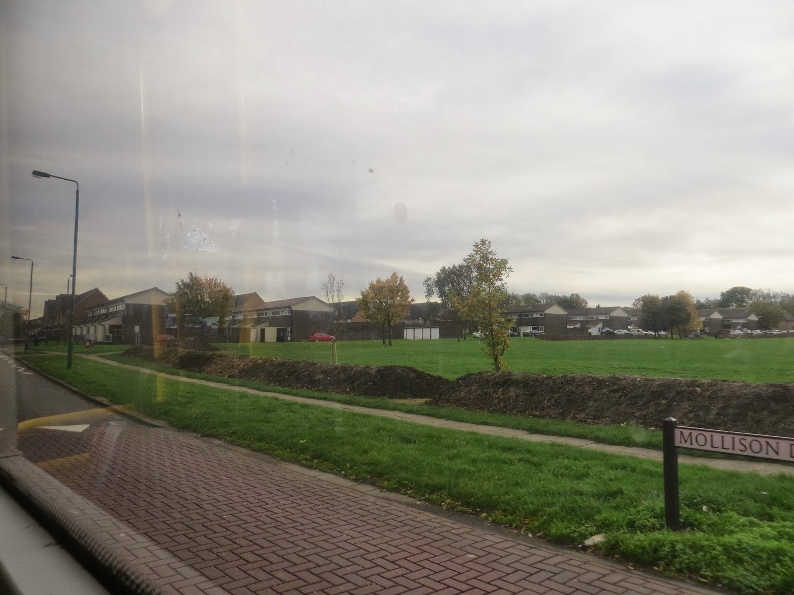 We realised we had reached the Roundshaw Estate when we passed the golden pillar box which celebrates David Weir's Olympic achievements.
 Noticing that a green area had had an earth bank put around it, we thought that it might be to prevent Travellers settling there. And indeed it was. Sutton appears to have only one official Traveller Site with 15 pitches on it.....
We passed St Elphege's School; I had assumed that this saint was female, but he was in fact an Archbishop of Canterbury, who tangled with the Danes and was martyred in the10th century. Wilson's School has a more recent history, having been founded in Camberwell and moved here in the 1970s. And it was at Wilson's School that we came to the end of our journey, at 11.50, after just over an hour of exploring the many residential areas around Sutton.
No comments:
Post a Comment