Saturday, 16 November 2013

The T32 Route

Addington Village Interchange to New Addington Parkway 
Thursday June  13th 2013

It is in fact only 4 short tram stops from end to end of this bus route and even with the weaving it accomplished underway it only managed to take 10 minutes. To our delight it was a double decker so gave us excellent views over the surrounding hills and countryside with just a glimpse of  Addington Palace, supposedly once a trysting place for King Henry and Anne Boleyn (who else?) when these were still hunting grounds. Nowadays it's a 'wedding venue' though Henry and Anne's relationship is hardly the best role model.

This historical link also accounts for the rest of the road names on our route downhill, recalling some of Henry’s advisors (there were many and it was easy to fall out of favour) such as Wolsey and Walsingham then crossing a small stream running through an area of green before climbing uphill again.

New Addington has something of a reputation as a ‘no-go’ area and indeed on our last trip a couple of years ago Mary and I were warned off from going to New Addington Parkway (a warning we ignored).  It’s not hard to see why.  Although the various parts of New Addington provide homes for about 21.000 people, making it one of the largest collections of social housing in the South East, communal facilities and shops are still not plentiful, some of the pubs have closed down and many of the green areas were thoughtfully provisioned with ‘NO BALL GAMES’ notices.  But there was a Youth Club in the Goldcrest Way Community Centre.


Having passed through and up the drives/streets/roads of homes with the odd block of flats we came to some industrial units – Bookstore.com and Angel Welding – and then arrived at Central Parade (the main shops for New Addington) and came to a halt by the Minor Injuries and GP Surgery complex, where this very brief journey terminated.

We explained the Project to the driver who was newly qualified and on his first trip on a T32 so we congratulated him and gave him a card. He did not really know why this route, of the three T routes deserves a double decker but there you are, he’s the lucky one. A waiting passenger spotted us as we descended and offered to take our photograph with the bus – we rarely appear on our own blog as we prefer to let our words speak for the journey and really the buses and drivers are the stars not us, but it was such a friendly gesture that we have included it.
 The Health Centre looked quite busy when I popped in to use the facilities with a preponderance of the elderly who would find this easier to access than the Mayday University Hospital – a good 30 minutes plus away.

Folks’ friendliness, and generosity of time continued as we walked and got lost several times from this stop to the start of the T31. As usual we headed in the wrong direction (though I always feel that a crescent is just a long way rather than wrong way round) and asked four locals to direct us to the start of the T31. Three of them told us but advised we take a bus as it was quite a long way. The fourth thought walking might be a good insurance against the extra calories we were about to consume come Christmas and more or less took us by the hand until she was sure we were on the path to the resting T31. It really was not very far but we enjoyed the chance for four local residents to disprove the negative publicity this area sometimes has (and which I fear I may have just added to). 

PS En route we saw a lovely ‘Old Man's Beard' clematis to go with the old women posing by the bus. ' I gather the other name is ‘Traveller’s Joy’ which is perhaps a better summary of this 10 minute trip.  

Wednesday, 13 November 2013

The T31 Route

Wednesday 13 November 2013

There are three 'T' buses, which nip around the outskirts of Croydon, and Linda, Mary and I resolved to travel them all in one day, since these are short and frequent routes. We also decided to travel in reverse numerical order, as a bus which starts at West Croydon is inordinately easy for us three Overground users.

So the T31 was the third of our buses on a beautiful, sunny day which made us wonder if we had imagined the horrid rain of the past few days. We walked the short distance from Park Way to Homestead Way, and set off to Forestdale at 11.10.

There were fine views of the countryside to the south of London as we turned back towards New Addington, and passed a house already decorated for Christmas. (Since I got home to find we had received our first Christmas Card, I suppose this is not entirely surprising)  Arnhem Drive is mainly semis, some with their original brick, some with pebbledash or white paint, and brought us to the centre of New Addington;  we travelled along Central Parade, picking up a number of shoppers, who knew one another and chatted as we swept along, parallel to the tram lines.


As well as flats with a Lidl underneath - a reminder of 'that' Tescos in Orpington with the flats above which we had visited so often earlier in the autumn, we came to Wolsey Primary School, with its cheerful notice: 'if you care, park elsewhere'.  The school appears, however, to have other reasons to be less than cheerful in the recent past.

Now we turned into the estates, and went up hill and down, through substantial areas of public and formerly public housing, passing a small parade of shops.  Then we came to the transport hub, where we had been less than two hours before, and headed straight out to pass the Randall Tavern.  It had had a bit of excitement back in 2010 as you can see here, but seemed to be thriving now.  Courtwood Lane brought us to the end of the route, at 11.35, after a brief but pleasant ride.


Friday, 8 November 2013

The S4 Route

Thursday 7 November 2013

Once again Linda and I were delighted to be joined by Mary J, who knows all about the Sutton area, but had never travelled the S4.  This goes from St Helier Station, to the Roundshaw Estate and, Mary informed us, passes all the schools, both primary and secondary, attended by her children.

We met at St Helier Station, more of a Halt than a major interchange, with grass between the two platforms and a single exit straight onto the road.  Not even Linda and I could get lost and we were onto our tiny single decker immediately, while the driver had his brief break.  We set off at 10.45.

Our first bit of road was very attractive, a wide dual carriageway with grass and a path in the central reservation.  We passed the enormous Methodist Church of St Helier and reached the few shops at Rose Hill, before coming to St Helier Hospital, which is about to have a major refit.


Now we turned again into residential roads, narrow and with many parked cars, despite the hardened front gardens.  We moved from the (mostly former) public housing into the private area, with a mixture of semis and bungalows, and many people got on at every possible 'hail and ride' pause.

We noted a wall which had seen better days, and wondered if it had been damaged by the high winds of a week ago;  our feeling was that if it was deliberate, the clearing and rebuilding might have begun, but if not, there might be a pause for the insurance assessors to have a look.  But this is speculation.


After a brief downhill stretch, we came to a few shops, and to one of those roundabouts that seems to have been planted up for when climate change converts south London into an arid zone.

Now we were coming into Sutton, for the last time as far as the project was concerned, so we kept a close eye on the features we had grown to know:  the blocks of flats, the large Salvation Army Centre, and the High Street with its laybys for buses.  Again we went along the backs of the shopping centre, and came to the cross roads where the old Police Station stands.  The new Police Station is named for a Community Police Officer murdered in the 1990s.

Rather than crossing the railway, we took a right to travel alongside it and turn left into Worcester Road.  Mary told us that it had once had large victorian and Edwardian houses, of which a few remain, but the area is now mostly occupied by more recently built apartments and smaller houses.

As we came past the lawn tennis club and headed into Downs Road, we felt as if we were coming to 'the country', at least to our right. Things are still very green, perhaps because the high winds removed a lot of golden foliage, leaving the rest.

Buses always go to hospitals, and this one is no exception, turning into the Royal Marsden before heading straight out again.

Banstead Road South led us to The Warren, and so to Woodmansterne Road.  Mary told us that the wooded area beyond included holdings established under the 1919 Land Settlement Act, which required the local authorities to provide small holdings for people who wanted to make a living in farming or market gardening.   

Queen Mary's Avenue once took people to one of the first Children's hospitals in the UK,  Queen Mary's Hospital.

Linda told us a story from her early days as a social worker:  a child had chewed the paint off the cot (and in those far off days, paint contained lead and was toxic), and had to be sent to Queen Mary's, all the way from Wandsworth.


We came past a large area of allotments, and some magnificent front gardens, with Japanese maples and fig trees, before we came into Wallington, and turned into the Station's back yard, where we had a change of driver.  We admired the fine planting, perhaps designed for dryer weather than we have been having, and Mary told us that the cactus-y looking things were Phormiums, originally from New Zealand. 
Wallington High Street brought us more passengers:  we had had a fairly empty period after leaving the Royal Marsden. The John Jakson Pub is named for a local lavender farmer: Wallington was an area famed for lavender and lavender oil.

Another fine sight was the handsome town hall, as we left Wallington and moved into part of the area which had once been Croydon Airport, and the street names, Roe, Brabazon, Amy, reflected the aviation history of the area


We realised we had reached the Roundshaw Estate when we passed the golden pillar box which celebrates David Weir's Olympic achievements.  

Noticing that a green area had had an earth bank put around it, we thought that it might be to prevent Travellers settling there.  And indeed it was.  Sutton appears to have only one official Traveller Site with 15 pitches on it..... 


We passed St Elphege's School;  I had assumed that this saint was female, but he was in fact an Archbishop of Canterbury, who tangled with the Danes and was martyred in the10th century.  Wilson's School has a more recent history, having been founded in Camberwell and moved here in the 1970s. And it was at Wilson's School that we came to the end of our journey, at 11.50, after just over an hour of exploring the many residential areas around Sutton.

Tuesday, 5 November 2013

The S3 Route

Sutton Hospital to Malden Manor Station 
Thursday October 30th  2013

And so to the middle of the trio of Sutton based routes – we thought for neatness sake there ought to be an S2, but it seems this number used to belong to a bus round Stratford but is no longer in use... 

Perhaps this is why the bus took some finding – hiding in the bushes perhaps? Gone for a stroll on the nearby Banstead Downs? Missing in Action? Run away to Stratford?

The bus map indicated the route starting at Sutton Hospital (of which more anon) so we presented ourselves at the Main Entrance and scanned the nearby car parks – a little shelter proved to be where you bought your car park ticket and nothing more so Jo asked an ambulance driver who indicated we needed to be right round the other side of the hospital and gave us a clear route through (‘or I could faint,’ said Jo, ‘and you could take me in the ambulance’ – a remark he wisely ignored). This allowed us to walk through what remains of Sutton Hospital and locate the bus, which was pretty much ready to go – there are three per hour. Boarding with us were two community police officers who sat either end of the back seat not talking to each other and finally got off very near the end of the route. How unlike us, the silence I mean.  Today Jo and I were joined by local Sutton resident Mary J, who provided gems of local knowledge and history for both routes. 

The still-working Sutton Hospital is part of the St Helier and Epsom Group and has some very key specialisms including eye treatment and pain management for chronic conditions, mainly on an out-patient basis. It was built later than the more deserted back buildings, where we found ourselves wandering.  This part has a long history, and the site was originally a workhouse known as industrial school for over 1000 ‘poor girls’ from London’s inner boroughs such as Lambeth, Southwark, Camberwell;  hence the name South Metropolitan Schools.

Still the contrast between Sutton with its empty corridors and boarded-up windows and the Royal Marsden, where the bus called in after its little detour to Belmont Railway station, was quite marked. The Royal Marsden is a state of the art research and treatment centre for cancer, and its buildings reflect its prestige.

From there we went along the ‘boundary’ between greater London and Surrey, but while catching a glimpse of Banstead Downs we were to head into a comfortable residential area known as Carshalton Beeches, including descending at some speed down one of Sutton’s steeper hills. It has its own period parade of shops, most of which are still thriving and would meet your every need.


Jo and I were back on project-familiar territory with our arrival in Carshalton village complete with its historic houses, pond and water tower. The bus passes along the substantial, and 'listed' brick wall that once housed Carshalton House and now encloses St Philomena’s Catholic High School for Girls. Philomena seems to have been a late arrival as saints go and a somewhat contentious one but the name remains popular as the release of this week’s film testifies.  Carshalton village is always attractive and with the glowing autumn colours even more so.

As is often the case with things called ‘new’ (think Pont Neuf in Paris) the Newtown part of Sutton actually indicates one of the older parts: building started once creeping industrialisation came. Sutton is far out enough to be on the ‘greensand’ border between the downlands’s chalk and London’s clay with the springs that came at the intersection of these geological layers allowing for the shape of the finger parishes including Carshalton and Sutton where we were today. Thus many of Sutton’s residents have chalk soil gardens.


Talking of chalk there were chalk pits here in living memory which explains why B&Q, so obvious on the one-way system, is so far below the road level. The S3 takes a rather back-streets approach to Sutton but inevitably joins the one-way system near B&Q and the police buildings, passing some rather empty (possibly due for demolition) office blocks, till we arrived at the station. What had taken Jo and me 20 minutes to walk seems to have taken the bus over half an hour, which tells you how convoluted was its route. Through Sutton town the transit was more conventional, taking St Nicholas Way along the back of the pedestrianised High Street where of course many shoppers, already sorted for the day, got on. This end of the High Street is obviously the go-to area for a wide range of ethnic eating which survive amongst some closed office blocks: Eagle Star Insurance are long gone, due for demolition and regeneration. 

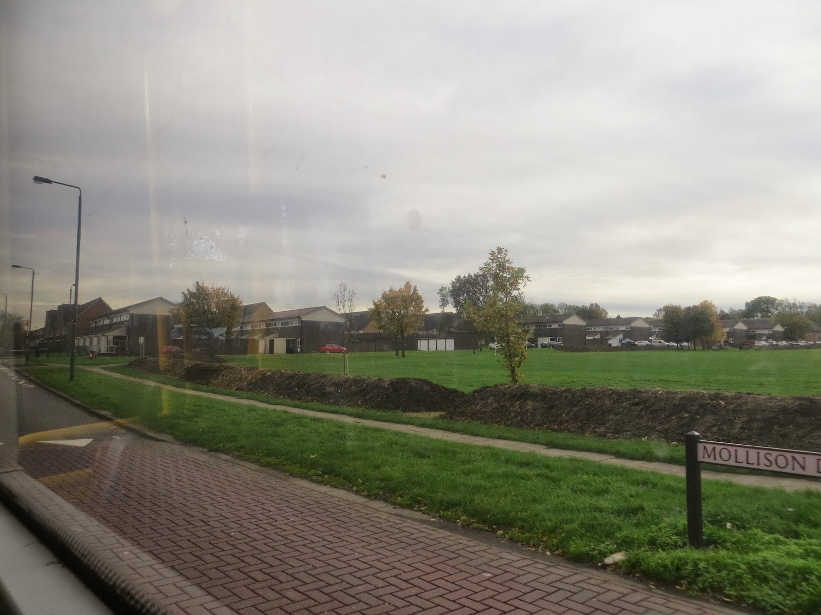
This route, unlike many, does not climb up Angel or Rose Hills but takes a left hand turn into West Sutton, a more restrained residential area and another ‘Hail and Ride’ section of the route. Not only were the houses more modest but the streets much narrower and quite difficult to negotiate with cars parked either side. Though barely visible the map indicates the presence of the Pyl Brook, a 5 mile tributary of the Beverley Brook

We then emerged onto what Mary called the ‘by-pass’ – the rather swifter A217 which takes a curve between Sutton and Cheam. The S3 is not a by-pass kind of bus but needed to deliver and take up passengers at the large Tesco Extra store built on the site of a former  GLC Waste Station (thank you Ediths’s Streets) and with space also for a range of other industrial units. Again in a ‘Hail & Ride’ section we progressed more swiftly this time through an area where the streets seem to be named for places along the River Thames (Windsor, Henley etc) before emerging onto our second major road, this time the A24. The press may tell us there is a supermarket war on but the S3 was certainly not taking sides – having passed Morrisons in Sutton and stopped for Tesco the S3 now does a positive in and out loop to take on customers for Sainsbury’s, returning along the same stretch of the A24 before plunging for its last ‘Hail & Ride’ section into what is arguably Worcester Park.

I say ‘arguably’ as apparently Worcester Park lies in three rather contrasting local authorities: Sutton from where we were coming, Kingston, and Epsom and Ewell which is not a London borough at all. This might account for the rather bland feel of the area though the housing is solid with some newer fill-ins especially along by the Beverley Brook. Beverley Brook may be better known to some as the daughter of Mama Thames in Ben Aaronovitch’s 'Rivers of London' novels so it is difficult to be harsh about her ‘home patch’.


At Worcester Park and its train station we lost the rest of the passengers, including the somnolent police officers (perhaps they know more about Beverley Brook than we do?) and the bus, well into its second hour of travelling, headed into the hinterland that calls itself Malden Manor Station. Sadly it feels like a very desolate roundabout with few cheering features, the eponymous Manor pub having shut since the last time we were here (on a K route) and the station not much more lively as it only seems to get two trains per hour. Mary’s vegetable samosa rather matched the general ambience and the platform could only summon a half-hearted train indicator so our really quite intriguing (what was round the next corner of which there were many?) S3 ended on something of a down note. 

Apologies -- photos somewhat adrift of text.

Thursday, 31 October 2013

The S1 Route

Wednesday 30 October 2013

We reached the start of the S1 at Little Green East in Mitcham by complex and varied means, including a train, a tram and a bit of a walk.  The weather was sunny and bright after the nastinesses of the earlier part of the week.  There were three of us:  our own Mary was busy, but we were lucky enough to have another Mary with us, a resident of Sutton and so a fount of local knowledge as we headed from Mitcham to Banstead.

Little Green is really quite a good sized green, with both the Mitcham War Memorial and the Wandle Industrial Museum. We shall have to return to visit it sometime.

Our single decker set off just after 1.30, and we turned left to begin a circuit of Mitcham's famous one way system and come to the Three Kings Pond and the start of Micham Common. We were a bit puzzled by the signs on the bus stops saying 'cross here for A and E' until Mary explained that they were road safety warnings, since many accidents happen as people rush to or from their buses.

As we came over the railway, we encountered slow traffic, including a funfair on the move,  but happily everyone seemed to want to head along the Croydon Road so we speeded up and got to Mitcham Junction Station without further delay.  Past the Goat Pub, we were out of Merton borough and into Sutton.  Sadly the Queen's Head pub has died, but we were glad to see the Wandle, which makes a good walk into the middle of London, should you want one.

We had been going fairly straight since Mitcham, but now we took a turn through a residential area, mostly semis with hardened front gardens,  and came into the St Helier Estate.  This was built in the 1920s to rehouse people from inner London, and was helped considerably by the extension of the Northern Line to Morden, nearby.  Thus we came to the great white whale which is the St Helier Hospital.  It is an impressive thought, in these austerity days, that it was opened in 1938, during an earlier and greater economic downturn, and before a National Health Service existed.  Mary told us that during the war it had been painted green, to make it less of a beacon for the Luftwaffe as they headed northwards.

Our route took us uphill and down until we reached Sutton Green.  We could see the remains of a gas holder to our right, but Mary told us it was to be demolished.  I find this interesting, as the gas holder frames north of King's Cross are being carefully renovated and will become a 'feature' in a posh new group of apartments.

Now we came into Sutton, where the buses pull off the main one way system into laybys alongside, so that passengers can get off without risking the traffic.  One of these has the Doctors' Surgery, formerly the magistrates court.  We were travelling with one of the practice's clients.  It is not a very beautiful stretch of road, as it is flanked by the backs of the big shops in the Centre.  Uphill and then over the main road, to reach South Point, an empty office block which may be demolished, or turned into homes, as has happened elsewhere in the borough, but for now, just looks dismal.


The Cock and Bull pub, however, looked very cheerful and, as we went over yet another railway, Mary explained that a number of different lines meet, overlap and cross here in Sutton.  We passed a multi storey  car park, also due for demolition, and then turned uphill along Cavendish Road.  Here we noticed a very few of the large old houses, between the apartment block which had replaced the others.  Although Sutton has a fine library in its own right, we were pleased to pass the Mobile Library van, doing its work. We could tell we were coming into a really prosperous area when we saw a street named 'The Gallop', rather than anything like 'Road' or 'Avenue'. 

Some of the houses were enormous.  We were interested in Cavendish Church and the houses around it, since they were faced with flint, in a way which we associated more with East Anglia than with South London.  A banner outside the church said it was celebrating 75 years, but if it has a website, I have not found it.

Linda also admired a house with a green roof, and were were all amused to see a group of young Lib Dems ready to do some leafletting in this Lib Dem Constituency.  At least we assumed they were merely leafletting, as we thought they looked a bit young for doorstep confrontations about broken pledges. 


The foliage in these gardens and open spaces is turning and looking very lovely in the sunshine, as we came down to Sutton Hospital, though we did not go into the grounds, but headed straight on.  On the other side of the road were elderly railings, which Mary said were all that remained of the Victorian Mental Hospital complex.  This also included a home for pauper children from London (though the word 'home' might be a bit misleading in this context).  It is now a very dense housing estate, but the railings remain,

Actually, the hospital is in Belmont, rather than Sutton, and Mary told us why the area has that name.  She will not be hurt if I say that I haven't verified all these entertaining details.  It all began when a prosperous man, John Gibbons, opened a pub in the 1850s, and named it the California Arms, as a tribute to the gold fields where he had made his fortune.  So when a railway station was built nearby, it was called California.  It seems that a trainload of school furniture went missing, and was eventually found on a dockside waiting for shipment to California, USA, and so the decision was made to change the name, and the California link was maintained by calling the area Belmont.  Even the pub is now called the Belmont.  Now, I think the school furniture bit of the story may be a bit far fetched, but as John Steinbeck once wrote,   a thing isn't necessarily a lie even if it didn't necessarily happen.  Mary points out that there is some detailed information here

Turning right along Sutton Lane, we passed the entrance to High Downs Prison, starting point of the Number 80 bus, many project-months ago, and came towards Banstead, through green countryside.

After Banstead's War Memorial, we came into the high street, with its wide range of shops, including the amazing Boutique Cakery, as well as several charity shops for local charities.

The planters were also admirable!  

We had been on the road for just about an hour, having a very enjoyable ride in splendid sunshine.  The way the drivers of these buses cope with parked cars, narrow roads and convoluted routes, as well as staying good natured and cheerful, is remarkable.

Now all that remained was to get out of Banstead!  While it's not as difficult as leaving Esher, the railway station is similarly far away, and the buses back to Sutton comparatively infrequent.  But it had been worth it.