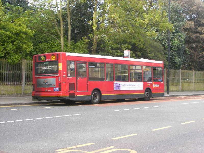
Sudbury Town Station to Edgware Station
Tuesday June 23rd 2009
Rather a strange way of joining a Piccadilly Line station to the end of the Northern Line, but for us bus travellers in fact the middle leg of a journey between the 18 and the 113. It was a glorious and sunny day as we walked the short distance between Sudbury and Harrow Road railway station passing a charming crocodile of nursery children in yellow reflective jackets (so as not to be left behind) and the departure point of the 204. The three of us admired them and settled ourselves upstairs in a very clean bus.
The children had in fact been in the Bartram Park and Library, which looked very pleasant but we had the less enjoyable experience of rather slow traffic back along the High Road. The bus retraced the route through Wembley, still in sight of the stadium arch, and past several South Asian restaurants including the Chennai Dosa, according to their publicity the fastest growing chain. Wembley has a fairly standard town centre with Brent municipal offices whose Community Services instruct you to Use Your BRAIN.
At Wembley Central we left our previous (18) route, and the traffic, behind and headed over the hills – excellent view towards Harrow and beyond as we crested the hill – steep too and even the pavements had handrails, I noted. This part of the route was largely residential with post-war semis of varying sizes but similar in design. We are very much on the outer side of the North Circular here even when following a parallel contour.
This time we crossed the Metropolitan Line and the Chiltern railway near the Preston pub and Preston Road (another stop on the Metropolitan Line) and up another hill to Kingsbury – this time tracking the Jubilee Line… really and truly in Metroland. We noted how many of these homes had bricked over their front gardens, presuming up on the hill they would not get flooded. As we crossed an open area called Roe Green
we noted a long low thatched house, as you might find in the country. However as the website tells you, it turns out to be something of a folly! They like to think of themsleves as a village though!
Hay Lane had the most enormous Ford car showroom, which, if I had thought, I should have recognised from the other perspective of the Edgware Road, but on this trip we crossed it (the Edgware Road) to penetrate Colindale quite thoroughly. We were promised the RAF museum but did not actually pass it though we did confront both the Colindale Labs, where police forensic and medical specimens rare enough to need a more specialist analysis are sent, plus of course the Colindale Newspaper Library , which is in fact part of the British Library. They have a very strict admission policy – over 21 and no pens – but are in the process of digitising.
The bus took us in and out of various new but quite dense developments, the Willows and Grahame- Park
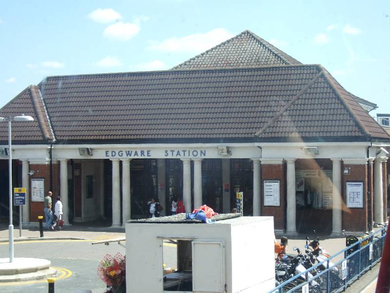
before rejoining Watling Avenue and the Edgware Road at Burnt Oak – much favoured as a shopping venue by RenĂ©e because of its excellent choice of fresh and quite exotic greengrocery. Most buses seem to have a hospital en route and so does the 204, and thus we passed the Edgware Community Hospital offering very modern out patients’ facilities, but few wards and no A&E for which you need to go all the way to Barnet. The bus swings right and into Edgware Bus station adjacent to the Broadwalk Centre where we could use the toilets and buy some lunch. I caused something of a health-and-safety stir in M&S by bleeding onto the conveyor belt (even though the wound was entirely self-inflicted: too much cuticle-chewing!).
We decided that with all its twists and turns through estates this route needed some memorising by the driver, as opposed to a straight up and down route.
Wednesday, 17 August 2011
Sunday, 14 August 2011
The Number 203 Route
Staines Bus Station to Hounslow Bus Station
Monday October 18th 2010
Staines bus station was something of a hybrid offering a few London buses, such as the 203 we boarded, but quite a range of Surrey and out of London buses too. The bus station is outside the Staines shopping centre and has been quite nicely landscaped with a range of predictable shrubbery, much appreciated by passengers who had been through Hounslow Bus Garage – unfriendly and unwelcoming as it is – twice today already.
We did in fact cross the borough boundary into Surrey somewhere along this route but failed to photograph this. Jo and I were somewhat puzzled as we remembered places like Ashford and Staines being in Middlesex , but they seem to have migrated into Surrey, making the latter one of the larger local authorities. Shows how out of date we are: it was apparently (thank you, Wikipedia) as long ago as 1965 that poor old Middlesex was carved up between London (loosely speaking) Hertfordshire for the north bits and Surrey for the Spelthorne area, which is what we were driving through today. So we were technically South of the River though west of the bend is more what it looks like. Middlesex remains as a postal tag and there are a few arcane sporting clubs that cling to it… As my Surrey ex social work friend reminds me Surrey reaches from Heathrow to Gatwick
I digress. We left the shopping centre behind and noted that as usual it has killed the High Street, leaving the usual collection of fast food eateries and specialist places – Pampurred Pets anyone?
Going back into Greater London this route has a few difficult right turns to negotiate but the delays these cause are easily compensated for by the significant stretches of dual carriageway, where no one chose to board the bus. Sadly not visible from a single-decker were the various reservoirs that are so very apparent when you come in to land at Heathrow – we passed along two sides of the Staines reservoir (built 1901) whilst across the road were fields with cows and horses in. Soon after comes the new looking Ashford Hospital not very easily distinguishable from the nearby Tescos, both seeming to be a bit in the middle of nowhere.
Then the bus goes into the significant amount of residential housing that seems to make up Bedfont – it was clearly once a village with a separate identity and village green but is now part of the urban sprawl. A more recent addition would seem to be the pub called ‘The Happy Landing’ complete with pub sign of Concorde on the tarmac. Given that it is now nearly seven years since the world’s loudest/fastest plane was retired they are nearly as ‘out of the loop’ as Jo and I knowing about this bit of territory being in Surrey. Maybe the landlord is too busy keeping the peace in his pub to think about a name change – on the website most entries have been censored out?? I have included the Concorde link because I know this plane has a very wide fan base.
We emerged from the solid streets of solid houses onto wider roads built up with warehousing and cargo facilities, also spotting the ‘Animal Reception Centre’ previously and more accurately known as the animal quarantine section. Rather strangely, this turns out to be run by the Corporation of London, the smallest, though far from poorest local authority in London.
We crossed over the River Crane, rather disciplined here, and came at Hatton Cross Underground /bus station from a different angle for once. As ever this heralded a major changeover of passengers with as many boarding as had got off. In fact it was standing room only, and a bit of a silent struggle ensued between a man trying to balance a huge suitcase and thus blocking what little there was in the way of an aisle while a young woman plus buggy was trying to pass through.
For once the bus stop indicators were significantly useless, offering such vague names as ‘Great West Road’ which runs all the way from Bedfont nearly into Hounslow. By now we were getting regular landing aircraft into our vision – undercarriage down for landing, airline affiliation legible but though Jo tried very hard with the camera the photos do not do justice as to how close these planes come to the rooftops of Bedfont and Hounslow.
By now we were on one of the familiar approaches to Hounslow town centre noting the newly built, recently opened GP Practice with a walk-in centre.
Today we were not walking anywhere except onto our last bus of the day, this longish in distance trip having taken about an hour. Unless you are a plane spotter this is not the most enthralling of routes and similar to some to come!
Monday October 18th 2010
Staines bus station was something of a hybrid offering a few London buses, such as the 203 we boarded, but quite a range of Surrey and out of London buses too. The bus station is outside the Staines shopping centre and has been quite nicely landscaped with a range of predictable shrubbery, much appreciated by passengers who had been through Hounslow Bus Garage – unfriendly and unwelcoming as it is – twice today already.
We did in fact cross the borough boundary into Surrey somewhere along this route but failed to photograph this. Jo and I were somewhat puzzled as we remembered places like Ashford and Staines being in Middlesex , but they seem to have migrated into Surrey, making the latter one of the larger local authorities. Shows how out of date we are: it was apparently (thank you, Wikipedia) as long ago as 1965 that poor old Middlesex was carved up between London (loosely speaking) Hertfordshire for the north bits and Surrey for the Spelthorne area, which is what we were driving through today. So we were technically South of the River though west of the bend is more what it looks like. Middlesex remains as a postal tag and there are a few arcane sporting clubs that cling to it… As my Surrey ex social work friend reminds me Surrey reaches from Heathrow to Gatwick
I digress. We left the shopping centre behind and noted that as usual it has killed the High Street, leaving the usual collection of fast food eateries and specialist places – Pampurred Pets anyone?
Going back into Greater London this route has a few difficult right turns to negotiate but the delays these cause are easily compensated for by the significant stretches of dual carriageway, where no one chose to board the bus. Sadly not visible from a single-decker were the various reservoirs that are so very apparent when you come in to land at Heathrow – we passed along two sides of the Staines reservoir (built 1901) whilst across the road were fields with cows and horses in. Soon after comes the new looking Ashford Hospital not very easily distinguishable from the nearby Tescos, both seeming to be a bit in the middle of nowhere.
Then the bus goes into the significant amount of residential housing that seems to make up Bedfont – it was clearly once a village with a separate identity and village green but is now part of the urban sprawl. A more recent addition would seem to be the pub called ‘The Happy Landing’ complete with pub sign of Concorde on the tarmac. Given that it is now nearly seven years since the world’s loudest/fastest plane was retired they are nearly as ‘out of the loop’ as Jo and I knowing about this bit of territory being in Surrey. Maybe the landlord is too busy keeping the peace in his pub to think about a name change – on the website most entries have been censored out?? I have included the Concorde link because I know this plane has a very wide fan base.
We emerged from the solid streets of solid houses onto wider roads built up with warehousing and cargo facilities, also spotting the ‘Animal Reception Centre’ previously and more accurately known as the animal quarantine section. Rather strangely, this turns out to be run by the Corporation of London, the smallest, though far from poorest local authority in London.
We crossed over the River Crane, rather disciplined here, and came at Hatton Cross Underground /bus station from a different angle for once. As ever this heralded a major changeover of passengers with as many boarding as had got off. In fact it was standing room only, and a bit of a silent struggle ensued between a man trying to balance a huge suitcase and thus blocking what little there was in the way of an aisle while a young woman plus buggy was trying to pass through.
For once the bus stop indicators were significantly useless, offering such vague names as ‘Great West Road’ which runs all the way from Bedfont nearly into Hounslow. By now we were getting regular landing aircraft into our vision – undercarriage down for landing, airline affiliation legible but though Jo tried very hard with the camera the photos do not do justice as to how close these planes come to the rooftops of Bedfont and Hounslow.
By now we were on one of the familiar approaches to Hounslow town centre noting the newly built, recently opened GP Practice with a walk-in centre.
Today we were not walking anywhere except onto our last bus of the day, this longish in distance trip having taken about an hour. Unless you are a plane spotter this is not the most enthralling of routes and similar to some to come!
Thursday, 11 August 2011
The Number 202 Route
Thursday 11 August 2011
'It's like April', said Linda, as another shower came and went, and bright sun shone; and as our umbrellas struggled with the wind, we agreed it was more like March. Linda and I were joined by Sue G, which was excellent as she knows almost everything about this route, from Crystal Palace to Blackheath. The camera was, regrettably, in Malvern (don't ask) but Linda did a pretty good job with my phone, despite it being a single decker with rained-on windows.
It was 10.20 as we set off, heading past the plaque for Francis Pettit Smith, without whom everything from cargo ships to canal boats might still be paddle driven. Sue told us that the St Clement's Heights retirement home was undergoing major developments, which would maintain the sheltered housing element of the Almshouses while providing other accommodation and - presumably - income.
Steeply down Wells Park Road, we passed attractive Wells Park with beautiful flowerbeds, before reaching the Talma Pub, named for the Hebrew word for 'hill', which is not inappropriate, given its location. Then we turned right to Cobbs Corner, so-called because of a former department store, passing the corner drinking fountain on the way. Sue pointed out the Greyhound Pub, closed and due for regeneration, but with two different developers, one doing the flats above, and the other the pub. Hmmm.
I also noted a Pub called 'The Two Half's' (sic) and Sue then told us about the controversy surrounding the Sydenham Post Office, where some people want to erect a Mosaic, while others object
There are some handsome buildings on this route, as we headed down towards Catford, including a house that had a brown plaque for Sir George Grove, he of the Dictionary of Music, and the Lewisham Credit Union. We also passed a new development, which is being built in a curve, presumably to 'reference' the elegant gas holders next door.
Our next landmark was the Tudor Livesey Memorial Hall, built as a social Club for the gas workers that Mr Livesey employed. It was a relief to see it active, as we passed a number of boarded up pubs, including the Rutland Arms along Catford Hill. Signs for the River Pool Linear Path led Sue to say that it had been a bit tidied up and so was less 'natural' but it seems it has been a disappointment for some time.

Getting into Catford was a bit slowed by water works, which brought the traffic down to a single lane, so we were able to admire a food shop called Africq, which was offering smoked catfish, as well as the Broadway Theatre and the famous black cat. We also admired 'Loctafari', a beauty shop which promised to provide for 'all your loc needs'.

From Catford to Blackheath is a very short distance, and we were soon admiring the handsome plasterwork of the Blackheath Conservatoire. In the village, a number of the attractive and interesting shops were boarded up , but with signs saying 'Open': evidence of the unpleasant events of the past few nights.
Our route took us across the heath, where there were Canada Geese feeding, to arrive at the Royal Standard by 11.10.
We'd had a pleasant journey, enlivened by Sue's wealth of interesting information. We had noticed several double decker 202s going in the other direction, so we felt a bit saddened; but the steep hills of this part of London might help to explain why they mostly use single deckers.
'It's like April', said Linda, as another shower came and went, and bright sun shone; and as our umbrellas struggled with the wind, we agreed it was more like March. Linda and I were joined by Sue G, which was excellent as she knows almost everything about this route, from Crystal Palace to Blackheath. The camera was, regrettably, in Malvern (don't ask) but Linda did a pretty good job with my phone, despite it being a single decker with rained-on windows.
It was 10.20 as we set off, heading past the plaque for Francis Pettit Smith, without whom everything from cargo ships to canal boats might still be paddle driven. Sue told us that the St Clement's Heights retirement home was undergoing major developments, which would maintain the sheltered housing element of the Almshouses while providing other accommodation and - presumably - income.Steeply down Wells Park Road, we passed attractive Wells Park with beautiful flowerbeds, before reaching the Talma Pub, named for the Hebrew word for 'hill', which is not inappropriate, given its location. Then we turned right to Cobbs Corner, so-called because of a former department store, passing the corner drinking fountain on the way. Sue pointed out the Greyhound Pub, closed and due for regeneration, but with two different developers, one doing the flats above, and the other the pub. Hmmm.
I also noted a Pub called 'The Two Half's' (sic) and Sue then told us about the controversy surrounding the Sydenham Post Office, where some people want to erect a Mosaic, while others object
There are some handsome buildings on this route, as we headed down towards Catford, including a house that had a brown plaque for Sir George Grove, he of the Dictionary of Music, and the Lewisham Credit Union. We also passed a new development, which is being built in a curve, presumably to 'reference' the elegant gas holders next door.
Our next landmark was the Tudor Livesey Memorial Hall, built as a social Club for the gas workers that Mr Livesey employed. It was a relief to see it active, as we passed a number of boarded up pubs, including the Rutland Arms along Catford Hill. Signs for the River Pool Linear Path led Sue to say that it had been a bit tidied up and so was less 'natural' but it seems it has been a disappointment for some time.
Getting into Catford was a bit slowed by water works, which brought the traffic down to a single lane, so we were able to admire a food shop called Africq, which was offering smoked catfish, as well as the Broadway Theatre and the famous black cat. We also admired 'Loctafari', a beauty shop which promised to provide for 'all your loc needs'.
From Catford to Blackheath is a very short distance, and we were soon admiring the handsome plasterwork of the Blackheath Conservatoire. In the village, a number of the attractive and interesting shops were boarded up , but with signs saying 'Open': evidence of the unpleasant events of the past few nights.
Our route took us across the heath, where there were Canada Geese feeding, to arrive at the Royal Standard by 11.10.
We'd had a pleasant journey, enlivened by Sue's wealth of interesting information. We had noticed several double decker 202s going in the other direction, so we felt a bit saddened; but the steep hills of this part of London might help to explain why they mostly use single deckers.
Tuesday, 9 August 2011
The Number 201 Route
Herne Hill to Morden Station
Monday April 11th 2011
It was to be another lovely spring day full of short trips through the inner and outer suburbs in small buses. The three of us were joined by a silent passenger, namely a large bag of box files re-cycling from Jo’s loft to her brother’s study; I say fourth passenger because they took up a whole seat and needed escorting on and off the buses, but were well brought up and offered their seat to those less able.
The 201 waits patiently by the side of Brockwell Park and departs 4 times an hour so we had a shortish wait for what was to prove quite a popular route. We’d met at Herne Hill station which was clearly coming up in the world having both local services and more First Capital Connect trains than previously.
But back to the bus – there have been road flow improvements at Herne Hill and very soon we were off the main roads and enjoying the stately (and much sought after) housing of the Croxted Roads – Edwardian villas with intact front gardens possibly due to being part of the Dulwich Estate, which has very strict rules about altering the character of your home/street.
Having made our way across these leafy byways we came out along the South Circular just before it reaches Tulse Hill, where it obliges traffic to go one way. We headed as for Brixton (lots of local knowledge here, especially for Mary who knows Lambeth very well) but then turned off along Tulse Hill Road and into the Roupell estate just passing the St.Martin-In-The-Fields High School for Girls, which also seems to give its name to a community centre on the Roupell Estate – I have failed to find out after whom the estate was named – its usually a worthy local councillor or historical figure but I did come across a wonderful 18th century rogue called William Roupell who sold falsified land claims for property he had no rights to, destroyed his father’s will and faked a more favourable replacement and after all this became an MP(!), so who knows?
Anyway the bus emerges from the pleasant back streets of the resident-run blocks, all interspersed with new children’s playgrounds, into Streatham High Road which must be one of the longest High Roads there are… and this may well be one of its problems, trying to keep up appearances over such a long stretch of commerce. Bits go down – no more Bowling, and Caesars, once a Locarno, looks a little sad by day – and bits go up: the espaliered trees along the central reservation were just budding, the closed Woolworth’s now a brightly lit Cash Converters, next to the odd punning shops such as Kebabilicious and Teh-niques. We had also never seen a a PO Box shop front before. By the time we passed the landmark St Leonard’s Church it was standing room only.
The bus carries on downhill into the rather more depressed Streatham Vale where we noted the Husul Centre offering British Citizenship Test though I was not sure if this was for teaching for rather than sitting the test?
Last week we had passed Lassa Road and this week it was to be Dahomey Road remembered in the borders between Streatham and Mitcham, where we were about to emerge alongside Figges Marsh. Apparently some rather vibrant yellow apparatus is provided for a sort of Adults’ playground though Jo seemed to think the generously provided ones in Camden mainly get used by dissolute youth as assembly points for smoking and bunking school?
Mitcham is well provided with Greens and also a range of bargain shops where many of our passengers were clearly heading. We may sigh as we again pass through the Mitcham one-way system but today it was quick and painless and enhanced by spring blooms. Jo was keen to point out that her brother in law had suggested naming the ubiquitous Viburnum Tinus ‘Viburnum Drabbia’, which is a little harsh – in Mitcham it was climbing over a wall otherwise undecorated.
We took a turn along the Morden Road, which was built up with Industrial Units, quite new and smart and backing onto the Tramlink behind them and Ravensbury Park opposite. Morden is well endowed with green spaces and soon we were alongside the old walls of Morden Hall itself on the now familiar approach to Morden Town centre, end of the Northern Line and start of many bus routes.
Monday April 11th 2011
It was to be another lovely spring day full of short trips through the inner and outer suburbs in small buses. The three of us were joined by a silent passenger, namely a large bag of box files re-cycling from Jo’s loft to her brother’s study; I say fourth passenger because they took up a whole seat and needed escorting on and off the buses, but were well brought up and offered their seat to those less able.
The 201 waits patiently by the side of Brockwell Park and departs 4 times an hour so we had a shortish wait for what was to prove quite a popular route. We’d met at Herne Hill station which was clearly coming up in the world having both local services and more First Capital Connect trains than previously.
But back to the bus – there have been road flow improvements at Herne Hill and very soon we were off the main roads and enjoying the stately (and much sought after) housing of the Croxted Roads – Edwardian villas with intact front gardens possibly due to being part of the Dulwich Estate, which has very strict rules about altering the character of your home/street.
Having made our way across these leafy byways we came out along the South Circular just before it reaches Tulse Hill, where it obliges traffic to go one way. We headed as for Brixton (lots of local knowledge here, especially for Mary who knows Lambeth very well) but then turned off along Tulse Hill Road and into the Roupell estate just passing the St.Martin-In-The-Fields High School for Girls, which also seems to give its name to a community centre on the Roupell Estate – I have failed to find out after whom the estate was named – its usually a worthy local councillor or historical figure but I did come across a wonderful 18th century rogue called William Roupell who sold falsified land claims for property he had no rights to, destroyed his father’s will and faked a more favourable replacement and after all this became an MP(!), so who knows?
Anyway the bus emerges from the pleasant back streets of the resident-run blocks, all interspersed with new children’s playgrounds, into Streatham High Road which must be one of the longest High Roads there are… and this may well be one of its problems, trying to keep up appearances over such a long stretch of commerce. Bits go down – no more Bowling, and Caesars, once a Locarno, looks a little sad by day – and bits go up: the espaliered trees along the central reservation were just budding, the closed Woolworth’s now a brightly lit Cash Converters, next to the odd punning shops such as Kebabilicious and Teh-niques. We had also never seen a a PO Box shop front before. By the time we passed the landmark St Leonard’s Church it was standing room only.
The bus carries on downhill into the rather more depressed Streatham Vale where we noted the Husul Centre offering British Citizenship Test though I was not sure if this was for teaching for rather than sitting the test?
Last week we had passed Lassa Road and this week it was to be Dahomey Road remembered in the borders between Streatham and Mitcham, where we were about to emerge alongside Figges Marsh. Apparently some rather vibrant yellow apparatus is provided for a sort of Adults’ playground though Jo seemed to think the generously provided ones in Camden mainly get used by dissolute youth as assembly points for smoking and bunking school?
Mitcham is well provided with Greens and also a range of bargain shops where many of our passengers were clearly heading. We may sigh as we again pass through the Mitcham one-way system but today it was quick and painless and enhanced by spring blooms. Jo was keen to point out that her brother in law had suggested naming the ubiquitous Viburnum Tinus ‘Viburnum Drabbia’, which is a little harsh – in Mitcham it was climbing over a wall otherwise undecorated.
For us it was the end of the line but only a short walk to our key route of the day.
We enjoyed the novel aspects of this route towards the start and nearer the end and were pleased to see how popular it was getting us from Herne Hill to Morden in just under an hour.
Wednesday, 3 August 2011
The Number 200 Route
Wednesday 3 August 2011
Today was a bit of a landmark, partly because it was the 200, but also because our first bus trip was made exciting by a photographer and a journalist. You'll have to wait till the 355 to learn the details, though we will provide a link when we get published, and I'll say a bit more near the end of this account. But for now, let's concentrate on the 200. Linda, Mary and I boarded close to one of several greens in Mitcham, where something exciting was clearly being planned for the afternoon. Tents were going up, and speaker systems being arranged. We picked up the bus in one of those 'buses only' laybys, just at the end of Mitcham High Street It was 12.45 and we were bound for Raynes Park on our second single decker of the day. The bus was very warm, as was the day, and busy with shoppers.
Next we came to the Cricket Green, the wicket looking particularly bleached, and passed a couple of derelict pubs as well as the enormous bulk of Mitcham Parish Church, and signs to Deen City Farm, which looks a fun place to visit.
We were within reach of Croydon's tram system along here, and passed the Phipps Bridge Tram stop as well as the Phipps Bridge Estate. Their signs are still using the older Merton logo. They seem to have a new one, which we saw in several places, a stylised waterwheel, which we meanly thought did not really match their strapline ('moving forward') since waterwheels tend to be fixed... You can see it at the top left hand side of their website.


We passed a tower block which seemed about to be demolished. It had once been called 'the Tower'; and then it was clear that we were nearing the Wandle, as the Nelson connection began to appear. First a pub called the 'Kiss me Hardy' and then the Nelson Arms, with a fine tiled depiction of HMS Victory on its wall. The Wandle, by the way, was looking healthy despite the lack of rain in these past weeks.
By now were were well into Colliers Wood, still picking people up as they did their shopping. We noted the Chakalaka South African Restaurant, before turning left to head towards Wimbledon.
I was interested to see an actual speed indicator for passing traffic. I live in a borough that pays lip service to 20mph as a preferred speed for residential roads, but does nothing to enforce the limit. Our bus slowed to less than 20, though that might have been the bumps rather than the sign.
Now we came into Wimbledon, passing the 'Centre Court' shopping centre as well as the 'Hand and Raquet' pub, before heading up Wimbledon Hill and into Wimbledon Village, with its large and handsome houses.
You may wonder why we have bothered with a photograph of an Estate Agent's shop. WELL, our first bus of the day was accompanied by a photographer and journalist as we may be featured in the KFH mag, Completely London. We have seen articles in the mag about the guerrilla knitters, and night workers in London, so we overcame our prejudices (caused by a very boring experience with a previous lot, who never did anything with the stuff, and wasted a lot of our time),and went with these nice people. We'll link to their website if we ever appear.
After passing the Westside Tennis Club, we headed steeply downhill to close in on Raynes Park, admiring the arts and crafts looking tiling on the outside of a substantial home.
We were amazed to see yet another new Waitrose: they seem to be springing up everywhere, and that brought us to Raynes Park Station, by 13.30, only a little over the advertised time for this route.
We had enjoyed the gentle suburbs of south west London, though air conditioning for buses might be a vote winner for the fighting mayors next year if this weather continues.
Next we came to the Cricket Green, the wicket looking particularly bleached, and passed a couple of derelict pubs as well as the enormous bulk of Mitcham Parish Church, and signs to Deen City Farm, which looks a fun place to visit.
By now were were well into Colliers Wood, still picking people up as they did their shopping. We noted the Chakalaka South African Restaurant, before turning left to head towards Wimbledon.
We were amazed to see yet another new Waitrose: they seem to be springing up everywhere, and that brought us to Raynes Park Station, by 13.30, only a little over the advertised time for this route.
We had enjoyed the gentle suburbs of south west London, though air conditioning for buses might be a vote winner for the fighting mayors next year if this weather continues.
Sunday, 31 July 2011
The Number 199 Route
Canada Water Station to Catford Bus Garage
Monday November 22nd 2010
Meeting at Canada Water Bus Station ‘brought it all back’ as this was where the Project started back in March 2009 with the Number 1 route. The memories were Jo’s as Linda had not been part of that trip. There have been lots of changes round Canada Water since then – a whole new Overground has opened, and there is significant building in an area, which has its history very much in merchant shipping and Docklands.
Not far away is the Norwegian church and Seamen’s mission and many of the names of streets, and indeed the whole area remind us these bits of London were once working docks and unloading quays for merchant shipping from all over the world, named for the Surrey side of the Thames.
Greenland Water gave shelter to whalers and the Scandinavians brought us wood, which was often precariously balanced by the specialist ‘Deal Porters’ that carried heavy high and costly piles of timber. The Surrey Canal (the remnants of which now command the way to the cinema Multiplex) was supposed to offer onward transport but was never that successful. The war-time bombs just about finished off the docks which were closed in the Sixties and then re-generated courtesy of the London Docklands Development Corporation so that you have what is today’s combination of shops and housing. The Redriff Dockers Shelter (a replica) with its mural offers some commemoration of this and now forms a bus shelter !
The bus in essence follows the River Thames through Deptford along Evelyn Street, named for the famous diarist, garden designer etc. The Thames Path also runs hereabouts, but not in one of its better-signposted stretches so easy to lose. Evelyn Street turns into Creek Road indicating where the Ravensbourne comes out into the Thames.
In fact you cannot fall over in Rotherhithe /Surrey Quays/Deptford /Greenwich without bumping into HISTORY of some sort so back to 2010. Creek Road is lined with student accommodation not linked specifically to any University it would seem?
This bus was in no hurry but mid morning on a Monday Greenwich itself was not congested so we went through the one-way system quite smartly taking in all the lovely buildings. So lovely, in fact, that there is an almost endless list of films and TV programmes that have filmed on location hereabouts – handily listed on this downloadable movie map .
What was the Naval College is now mostly Greenwich University including the newish Stephen Lawrence Building, and then on past the Market (Excellent but VERY crowded at weekends) and the lovely Hawksmoor St. Alfege's church currently being restored. Deptford has an equally strong naval and Thameside history – the shame of it being it is now so built up along here you can no longer glimpse the River.
More water – by now the Thames is away behind us but we are following the Quaggy, rather aptly named I fear. The attached group are keen to resurrect the river, now a glorified drain, to its former glory. Crossing the Quaggy means of course we had arrived in Lewisham Town Centre which for several months has been barricaded off to traffic while they replace sewers so we were on diversion round the back of the Lewisham Centre.
The bus, never full to start with, was now in competition with a range of routes that ply their trade between Lewisham and Catford, so did not have that many takers.
Given the number of routes along here it is always quite surprising that they do not jam more passing Lewisham Hospital, Registry Office and all the other useful offices and landmarks along here – War Memorial and University Hospital, Job Seekers, Housing Options, Rushey Green Children’s Centre, Kaleidoscope Centre, and finally Lewisham Town hall, Theatre and Civic Centre – all located squarely in Catford.
Lewisham is a long, thin borough and today we had spent quite a lot of time dipping in and out of it on various routes.
Bromley Road is nicely wide so most drivers take the opportunity to speed up as they approach route’s end at Catford Bus Garage, and today was no exception.
A surprisingly quick route, just under an hour, which offers the passenger a tour through London’s waterside history, post-war urban development and a range of shopping opportunities.
Monday November 22nd 2010
Meeting at Canada Water Bus Station ‘brought it all back’ as this was where the Project started back in March 2009 with the Number 1 route. The memories were Jo’s as Linda had not been part of that trip. There have been lots of changes round Canada Water since then – a whole new Overground has opened, and there is significant building in an area, which has its history very much in merchant shipping and Docklands.
Not far away is the Norwegian church and Seamen’s mission and many of the names of streets, and indeed the whole area remind us these bits of London were once working docks and unloading quays for merchant shipping from all over the world, named for the Surrey side of the Thames.
Greenland Water gave shelter to whalers and the Scandinavians brought us wood, which was often precariously balanced by the specialist ‘Deal Porters’ that carried heavy high and costly piles of timber. The Surrey Canal (the remnants of which now command the way to the cinema Multiplex) was supposed to offer onward transport but was never that successful. The war-time bombs just about finished off the docks which were closed in the Sixties and then re-generated courtesy of the London Docklands Development Corporation so that you have what is today’s combination of shops and housing. The Redriff Dockers Shelter (a replica) with its mural offers some commemoration of this and now forms a bus shelter !
The bus in essence follows the River Thames through Deptford along Evelyn Street, named for the famous diarist, garden designer etc. The Thames Path also runs hereabouts, but not in one of its better-signposted stretches so easy to lose. Evelyn Street turns into Creek Road indicating where the Ravensbourne comes out into the Thames.
In fact you cannot fall over in Rotherhithe /Surrey Quays/Deptford /Greenwich without bumping into HISTORY of some sort so back to 2010. Creek Road is lined with student accommodation not linked specifically to any University it would seem?
This bus was in no hurry but mid morning on a Monday Greenwich itself was not congested so we went through the one-way system quite smartly taking in all the lovely buildings. So lovely, in fact, that there is an almost endless list of films and TV programmes that have filmed on location hereabouts – handily listed on this downloadable movie map .
What was the Naval College is now mostly Greenwich University including the newish Stephen Lawrence Building, and then on past the Market (Excellent but VERY crowded at weekends) and the lovely Hawksmoor St. Alfege's church currently being restored. Deptford has an equally strong naval and Thameside history – the shame of it being it is now so built up along here you can no longer glimpse the River.
More water – by now the Thames is away behind us but we are following the Quaggy, rather aptly named I fear. The attached group are keen to resurrect the river, now a glorified drain, to its former glory. Crossing the Quaggy means of course we had arrived in Lewisham Town Centre which for several months has been barricaded off to traffic while they replace sewers so we were on diversion round the back of the Lewisham Centre.
The bus, never full to start with, was now in competition with a range of routes that ply their trade between Lewisham and Catford, so did not have that many takers.
Given the number of routes along here it is always quite surprising that they do not jam more passing Lewisham Hospital, Registry Office and all the other useful offices and landmarks along here – War Memorial and University Hospital, Job Seekers, Housing Options, Rushey Green Children’s Centre, Kaleidoscope Centre, and finally Lewisham Town hall, Theatre and Civic Centre – all located squarely in Catford.
Lewisham is a long, thin borough and today we had spent quite a lot of time dipping in and out of it on various routes.
Bromley Road is nicely wide so most drivers take the opportunity to speed up as they approach route’s end at Catford Bus Garage, and today was no exception.
A surprisingly quick route, just under an hour, which offers the passenger a tour through London’s waterside history, post-war urban development and a range of shopping opportunities.
Tuesday, 26 July 2011
The Number 198 Route
Thornton Heath High Street to Shrublands
Monday July 25th 2011
It was a real summer’s day when Mary and I met at Thornton Heath Station to walk back down the High Street to the start of the 198 route. Passing through by bus Thornton Heath can look a little weary but with a chance to admire the range of mangoes (imported) and lack of gooseberries (home grown) we decided the shops were holding their own against the Tescos by the station. Several 198s passed us so we knew we would not have long to wait.
At the bus stop we met a chatty A&E staff nurse on his day off and he was pleased about the sunshine too and in fact rode most of the route with us. It was the first week of the holidays and how can you tell—much less traffic and more families and children on the buses.
The bus’s first job is to get itself facing the right way to travel the length of the High Street passing the new leisure centre (an attempt to kickstart some regeneration, we thought) the rather handsome Thomas Farley Pub – the reviews think little of it but it has a handsome exterior, and who was Thomas Farley? I know pub signs aren’t known for their likenesses or accuracy but roughly speaking this one offered a Victorian country squire, which seems an unlikely match for the New York medical officer or the journalist (both modern) or the 1600 chap who emigrated to Jamestown US which Google offers. The corner has a Crossways garden centre, a biggish Tescos and Ambassador House, where Mary had encounters she would rather forget. Thornton Heath station has quite an attractive exterior and the bus then heads down Brigstock Road – another sign of regeneration being the library annexe along here. And of course the Clocktower.
Very soon we were in the Mayday Hospital belt around which there are signs of improvement – a brand new mosque (expecting up to 30,000 per week through Ramadam), a refurbished and extended hotel with 100 rooms, and what seemed to me a random Boots Optical store outlet but which clearly has some hospital links. The booking website refers to a ‘tranquil corner of South London’ which is not the description I’d choose for this quite bustling bit of West Croydon. There has been building here with some rather tall blocks which do not fit well with the more modest scale of the older properties hereabouts – tall is for Wellesley Road and Central Croydon. Along the London Road there is a large plot which remains empty – presumably some kind of dispute – and which now offers a haven of wildlife where the buddleia and grasses have gone wild.
We felt the pubs we passed had missed tricks and could have had more explicit and entertaining pub signs than they did – ‘Saints and Sinners’ for example and the ‘Ship of Fools.’ The story for the latter harks back to a medieval allegory about a pilotless vessel populated by human inhabitants who are deranged, frivolous, or oblivious to their destination. Umm, could this be a description of the ‘Ladies Who Bus’ ??)
The other pubs: Arkwright’s Wheel and the Fox & Hounds opposite West Croydon station were trying a bit harder. We covered the very familiar territory from West to East Croydon – with just a nod to the excellent hanging baskets on the barriers – very smartly, and were soon out on the quieter (?tranquil corner of South London) Addiscombe Road complete with double fronted homes, a tramroute and, just by the Shirley roundabout, the prestigious and private Trinity School – it was they who sold their Central Croydon site which gave the world (or at least South London) the Whitgift Centre and Trinity a nice new site. Shirley morphs into West Wickham – this whole route mainly composed of broad avenues sizeable homes and open spaces – some of them reserved for golf.
The Tudor Lodge is more pretentious than some of the homes but you have to give them a round of applause for their chutzpah – there are even traditional twirly Tudor chimneys. Much of Monks Orchard is still owned/occupied by outposts of the Bethlem and Maudsley Hospital, one of the UK’s more prestigious psychaitric treatment facilities. On the whole the wards down here offer very specialist services for which you need a referral.
The last little bit of this route, which for much of its way duplicates others and in particular the 194, branches off down Bridle Road to Shrublands, an apt name for an estate built by Croydon and completed in the late Fifties (and they also built shops and a pub’The Goat’) to deal with the post-war housing shortage. Building on shrublands, they left plenty of grass and the homes all have gardens. Shrublands also has its very own bus route: the very regular 198 which starts and stops here.
As we got off downstairs another passenger looked rather surprised and said ‘Was the bus going on to Bromley?’ and she was mortified, as a long time local resident, to realise that back in Shirley, where there was a choice, she had got on the 198 rather than the 119 . I was tempted to say ‘should have gone to Specsavers’ (or indeed the Boots near the Mayday) but instead we, and the helpful driver suggested she rode the next one out of town and picked it up there…
We gave our driver a card and contrary to the usual bemused stare Driver SHAH Badge Number 78444 gave us his card. He told us he had been driving for 46 years and remembered the Route 109 when it used to start in Purley and go to Westminster. We said we would record that he had driven carefully and thoughtfully on a quiet day on a journey that had taken us about 40 minutes through the South East London’s greener suburbs.
Monday July 25th 2011
It was a real summer’s day when Mary and I met at Thornton Heath Station to walk back down the High Street to the start of the 198 route. Passing through by bus Thornton Heath can look a little weary but with a chance to admire the range of mangoes (imported) and lack of gooseberries (home grown) we decided the shops were holding their own against the Tescos by the station. Several 198s passed us so we knew we would not have long to wait.
At the bus stop we met a chatty A&E staff nurse on his day off and he was pleased about the sunshine too and in fact rode most of the route with us. It was the first week of the holidays and how can you tell—much less traffic and more families and children on the buses.
The bus’s first job is to get itself facing the right way to travel the length of the High Street passing the new leisure centre (an attempt to kickstart some regeneration, we thought) the rather handsome Thomas Farley Pub – the reviews think little of it but it has a handsome exterior, and who was Thomas Farley? I know pub signs aren’t known for their likenesses or accuracy but roughly speaking this one offered a Victorian country squire, which seems an unlikely match for the New York medical officer or the journalist (both modern) or the 1600 chap who emigrated to Jamestown US which Google offers. The corner has a Crossways garden centre, a biggish Tescos and Ambassador House, where Mary had encounters she would rather forget. Thornton Heath station has quite an attractive exterior and the bus then heads down Brigstock Road – another sign of regeneration being the library annexe along here. And of course the Clocktower.
Very soon we were in the Mayday Hospital belt around which there are signs of improvement – a brand new mosque (expecting up to 30,000 per week through Ramadam), a refurbished and extended hotel with 100 rooms, and what seemed to me a random Boots Optical store outlet but which clearly has some hospital links. The booking website refers to a ‘tranquil corner of South London’ which is not the description I’d choose for this quite bustling bit of West Croydon. There has been building here with some rather tall blocks which do not fit well with the more modest scale of the older properties hereabouts – tall is for Wellesley Road and Central Croydon. Along the London Road there is a large plot which remains empty – presumably some kind of dispute – and which now offers a haven of wildlife where the buddleia and grasses have gone wild.
We felt the pubs we passed had missed tricks and could have had more explicit and entertaining pub signs than they did – ‘Saints and Sinners’ for example and the ‘Ship of Fools.’ The story for the latter harks back to a medieval allegory about a pilotless vessel populated by human inhabitants who are deranged, frivolous, or oblivious to their destination. Umm, could this be a description of the ‘Ladies Who Bus’ ??)
The other pubs: Arkwright’s Wheel and the Fox & Hounds opposite West Croydon station were trying a bit harder. We covered the very familiar territory from West to East Croydon – with just a nod to the excellent hanging baskets on the barriers – very smartly, and were soon out on the quieter (?tranquil corner of South London) Addiscombe Road complete with double fronted homes, a tramroute and, just by the Shirley roundabout, the prestigious and private Trinity School – it was they who sold their Central Croydon site which gave the world (or at least South London) the Whitgift Centre and Trinity a nice new site. Shirley morphs into West Wickham – this whole route mainly composed of broad avenues sizeable homes and open spaces – some of them reserved for golf.
The Tudor Lodge is more pretentious than some of the homes but you have to give them a round of applause for their chutzpah – there are even traditional twirly Tudor chimneys. Much of Monks Orchard is still owned/occupied by outposts of the Bethlem and Maudsley Hospital, one of the UK’s more prestigious psychaitric treatment facilities. On the whole the wards down here offer very specialist services for which you need a referral.
The last little bit of this route, which for much of its way duplicates others and in particular the 194, branches off down Bridle Road to Shrublands, an apt name for an estate built by Croydon and completed in the late Fifties (and they also built shops and a pub’The Goat’) to deal with the post-war housing shortage. Building on shrublands, they left plenty of grass and the homes all have gardens. Shrublands also has its very own bus route: the very regular 198 which starts and stops here.
As we got off downstairs another passenger looked rather surprised and said ‘Was the bus going on to Bromley?’ and she was mortified, as a long time local resident, to realise that back in Shirley, where there was a choice, she had got on the 198 rather than the 119 . I was tempted to say ‘should have gone to Specsavers’ (or indeed the Boots near the Mayday) but instead we, and the helpful driver suggested she rode the next one out of town and picked it up there…
We gave our driver a card and contrary to the usual bemused stare Driver SHAH Badge Number 78444 gave us his card. He told us he had been driving for 46 years and remembered the Route 109 when it used to start in Purley and go to Westminster. We said we would record that he had driven carefully and thoughtfully on a quiet day on a journey that had taken us about 40 minutes through the South East London’s greener suburbs.
Subscribe to:
Posts (Atom)